FASHION & BEAUTY
Territorial Scenarios | How governance reshaped the same territory over time
Why fragmentation is a historical configuration, not a technical failure The territory did not begin fragmented. Rivers, slopes, fertile soils,...
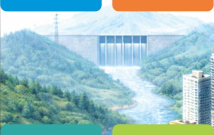
Scenario V | When territory demands coherence
As decades of sectoral evolution accumulate, interdependence becomes unavoidable. Mobility affects land value, water systems constrain urban growth, and infrastructure...
Territorial Scenarios | How governance reshaped the same territory over time
Why fragmentation is a historical configuration, not a technical failure The territory did not begin fragmented. Rivers, slopes, fertile soils,...
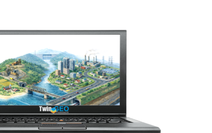
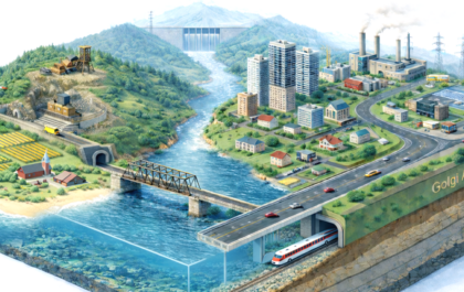
Territorial System | Before institutions, there was territory
Understand territory as an integrated system shaped by natural, built, social, and economic environments, where governance begins before institutions.
Territorial Scenarios | How governance reshaped the same territory over time
Why fragmentation is a historical configuration, not a technical failure The territory did not begin fragmented. Rivers, slopes, fertile soils,...
Scenario V | When territory demands coherence
As decades of sectoral evolution accumulate, interdependence becomes unavoidable. Mobility affects land value, water systems constrain urban growth, and infrastructure...


Amazing Car Paint Jobs We Seen So Far
Lorem ipsum dolor sit amet, consectetur adipiscing elit. Nam laoreet, nunc et accumsan cursus, neque eros sodales lectus, in fermentum...

Porsche Cayman Re-style Is On The Way
Lorem ipsum dolor sit amet, consectetur adipiscing elit. Nam laoreet, nunc et accumsan cursus, neque eros sodales lectus, in fermentum...

What You Need To Know About New Speed Limit Restrictions
Lorem ipsum dolor sit amet, consectetur adipiscing elit. Nam laoreet, nunc et accumsan cursus, neque eros sodales lectus, in fermentum...


Stay connected