Master in Legal Geometries.
What to expect from the Master in Legal Geometries.
Throughout history it has been determined that the real estate cadastre is the most effective tool for land management, thanks to this, thousands of spatial and physical data associated with a land are obtained. On the other hand, we have seen that recently the Master in Legal Geometries, an interesting project of the Polytechnic University of Valencia, and promoted by the Higher Technical School of Geodetic, Cartographic and Topographic Engineering. The introduction of this term "Legal Geometries" is curious, so we located one of the representatives of this Master to clarify the doubts that come with its definition.
La Dr. Natalia Garrido Guillén, director of the Master and member of the Department of Cartographic Engineering, Geodesy and Photogrammetry of the Universitat Politècnica de València, reveals the bases of the Master, the allies that have participated in this project, as well as the reasons why it was created.

Legal Geometry
We start with a basic definition, if we search for the term "Legal Geometry" on the web it is defined as the integration of mathematics in law, more specifically the use of geometric figures to make delimitations. Dr. Garrido tells us that this definition is correct.
Legal Geometry is precisely that, the search for the integration of Law in the technical processes of delimitation of property, since this, property, is nothing but a legal act. The question that remains in the air is to know if this definition is immersed in terms of the scope of the cadastre. Natalia comments that in a certain sense yes - it is almost the same as what the cadastre is-, but specifically in Spain, since there is no geometric cadastre there, since the mapping has not been formed by fixing vertices from delimitation.
Furthermore, it seeks to adapt, with a five-year delay, to that need to coordinate both worlds. And it seeks it by pretending that the technicians are the ones who lead this coordination, since it is a fit that has its common point in the parcel geometry. Therefore, yes, it is framed in the legal sphere, but with the intention of, through this coordination, splashing the fiscal-tax sphere by making the latter dependent on the former. In addition, it adds that it applies to both public and private goods. By rotating around property, it can be exercised both privately and publicly and, in both cases, in a wide range of possibilities.
This Master It is an academic proposal of the Univesitat Politècnica de València that, although the Registrars have shown their support for it, in global terms it has a technical vocation, and therefore the Spanish Association of Expert Geometrists has been used as specialist advisers. However, and with the intention of seeking the necessary harmony with legal operators, an attempt has been made to adapt the agenda to different profiles. That is why the master's degree is divided into two differentiated university degrees that, although they are interesting as a whole, one addresses the more technical part and the other the purely legal one, with the aim of being able to complement the basic information of both jurists, in the first case, as of the technicians, in the second.
As indicated by Dr. Garrido, the interested party will be able to choose between her various degrees: Diploma of Specialization in Legal Geometries, University Expert in Georeferencing and Master in Legal Geometries. For example, those who wish to obtain the title of University Expert in Georeferencing, referring to the spatial component of the Master, only need to pass module II, specifically the subjects Topography, Geodesy, Cartography and Geographic Information Systems applied to real estate.
In the case of the Diploma of Specialization in Legal Geometries, Module I and Module III must be passed. To meet the study objectives, the applicant will have master classes via the web - transmitted by videoconference in real time-; and later recorded to access in delayed mode.

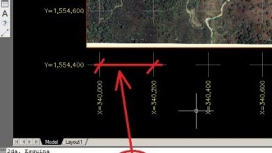
Now let's see, the Master's purpose is for the graduate to have the necessary tools to carry out a geometric delimitation of the property for cadastral or registry purposes, they clearly established the spatial component, so for this, cartography and geomatics play a fundamental role. Dr. Garrido emphasizes that it is not possible to define a property geometry, with the implications that it may have in terms of conflict and social peace without having the most appropriate means, techniques and knowledge in this regard, those of Topography, Cartography, Geodesy and Geographic Information Systems.
Likewise, it highlights that, although we are at a time when we are betting on the 3D cadastre, the master's degree is not oriented towards a cadastral intervention, although it will have aspects that affect it. In any case, and although international organizations, such as the FIG, have been betting on the 3D Cadastre model for almost a decade, in Spain it is just beginning to be implemented at the moment, so addressing this specific issue would be impossible. What this master does address are the aspects of real rights and administrative limitations that fall on geospatial objects, and therefore give meaning to the 3d cadastre beyond mere three-dimensional representativity.
So far we know that the Master is aimed at professionals who wish to receive comprehensive training -legal and technological- for the precise delimitation of real estateTherefore, he defines this term as the intervention of a technician who gives certainty, reliability and acknowledges responsibility for the geometric definition work; something that, although it seems incredible, is not an essential requirement in Spain.
On the other hand, there are major flaws in the delimitation of real estate, so the fundamental gap to be filled is the lack of a technical profile with extensive knowledge of law. Something undoubtedly necessary if we take into account that property is a matter that emanates from the Law and is constantly affected by it — legal limitations, administrative easements, urban aspects, tax legality, etc.—.
Let's talk about the accelerated changes in technology (virtual reality, augmented, Iot) and development / spatial use, however, the contribution of the Master to the 4th digital era is uncertain. At first and given that, as has been said, the 3D Cadastre has a limited implementation in Spain, due to the fact that it only includes three-dimensional objects without the legal definition that interoperates with their environment, and an example of all this is the type properties deck for which there is no combined solution that protects them. Likewise, infrastructures, especially underground ones, have a legal and physical impact on both private and public properties, and therefore are very important to take into account in augmented reality applications. Therefore, the integration of legal geometry processes with BIM and similar environments is a space to explore
After knowing the purpose of the "Legal Geometry", Natalia spoke to us about the interoperability and safeguarding of the data, emphasizing that legal geometry is the tool for obtaining, processing, processing and validating physical and legal data? The system that encompasses this information and its dissemination is an application that we assume is the responsibility of governments to develop.
This system that, currently in Spain, is dispersed among the different organizations, such as the cadastre, property registers, municipal urban planning entities, and sector administrations (owners of the public domain) .Therefore, one of the key aspects of the The content of the master is to provide skills to know in detail the interoperability of this system that is not only valid for applying it in the short term, but also promoting improvements in the medium and long term.
We would say then that Legal Geometry would come to put in order a quantity of isolated data, raised in a dispersed way and without a specific purpose. The idea for the materialization of the project comes from La Spanish Association of Expert Geometrists that raised an uncovered educational niche to the Higher Technical School of Geodetic, Cartographic and Topographic Engineering of the Polytechnic University of Valencia. After assessing the viability, he raised the possibility of developing his own degree within his academic range that would explore this market need.
As it is a Master's degree to train experts, teachers are experts in the subjects they teach, whether they are university professors (from the Polytechnic University of Valencia and the University of Valencia), or if they come from official organizations (National Geographic Institute , Property Registry, Cadastre ...), or the world of work. In this sense, to facilitate conciliation with the work activity of the students, the classes will be transmitted by streaming and will be recorded for possible delayed viewing.
In relation to financial aid or scholarships, Dr. Garrido stated that "Currently there are no aid of this type, as it is a qualification of the Polytechnic University of Valencia, it is not eligible for official aid." The interested party can enroll From the master's website, there is all the information on the costs of the qualifications that can be applied for.
More about the Master
To conclude, let's consider that space is continually changing drastically, for some it turns out to be a benefit, and for others it is a big problem. The fact of having the resources and assets delimited correctly, allows other processes to be properly executed, and therefore contributes favorably to geospatial development.
We always talk about what is required to qualify an area as a Smart City or Smart City, it goes beyond the integration of Information and Communication Technologies, sensors or others; really the first step is to know what there is, where it is and what is the best way to take advantage of it.
By having all these concepts clear, having updated-automated territorial information, and allowing it to be accessible to all types of public, we can begin to rethink what we want to obtain and how to obtain it. And added to this, trained professionals with the best tools are required to face all the challenges involved in addressing this 4th digital era. You can review the entire conversation with Dr. Natalia Garrido at Twingeo Magazine 5th Edition.