
AutoCAD 2013
-
AutoCAD-AutoDesk

View and convert dwg files from different versions of AutoCAD
In general, when they send us a dwg file, there is usually a problem with the version with which they were saved. Here are some ways to solve the problem: What version of dwg This is not possible to identify, because the file…
Read More » -
AutoCAD-AutoDesk
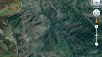
Google Earth 7 limits the capture of rectified ortho images
When the new version of Plex.Earth 3 is about to come out, we realize that although it supports the loading of web map services, the great advantage it has had so far of being able to download the image of…
Read More » -
AutoCAD-AutoDesk

Plex.Earth 3.0 Load WMS services from AutoCAD
Plex.Earth 3.0 has arrived for the first time, which I have had time to test while the final version availability date is defined. Possibly in the month of November 2012. It runs with AutoCAD 2013 Perhaps the most…
Read More » -
AutoCAD-AutoDesk
Free AutoCAD Course, Available for Download
Some time ago we published the version of this Free AutoCAD Course, now the version for AutoCAD 2013 has been released, in which you can download the first section for free and additionally: Now you can buy it for…
Read More » -
Maps
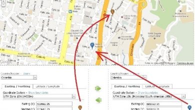
View UTM coordinates on Google Maps, and using ANY! Other coordinate system
Until now it had been common to see UTM and geographic coordinates on Google Maps. But usually keeping the datum supported by Google which is WGS84. But: What if we want to see in Google Maps, a coordinate of Colombia in MAGNA-SIRGAS, WGS72…
Read More » -
AutoCAD-AutoDesk

Generate cross-sections with CivilCAD
With this article we welcome the new face of the official CivilCAD site, a great job by the friends of ARQCOM on the eve of its 15th anniversary with more than 20,000 users in Latin America. In its…
Read More » -
AutoCAD-AutoDesk

What has been the best version of AutoCAD?
We often see the question out there, about which version is better or why we defend it; then when a new one arrives it is usually said that it is only makeup. Anyway, as a starting point we made the query on Facebook, where Geofumadas…
Read More » -
AutoCAD-AutoDesk

Projected view and section cut with AutoCAD 2013
Among the most significant changes in recent versions of AutoCAD is the work with 3D models. There was a request in the AutoCAD 3D categorized forums that some Inventor features be ported to the base version and possibly to...
Read More » -
AutoCAD-AutoDesk

Summary: What's new in AutoCAD 2013 compared to other versions
This table summarizes the news that AutoCAD 2013 has in relation to the changes reported by AutoDesk in the latest versions (AutoCAD 2012, 2011 and 2010) It is clear that these are the significant news that AutoDesk reports, some of these…
Read More » -
AutoCAD-AutoDesk

5 What's New in AutoCAD 2013
Some of the news that we have seen in the beta version of AutoCAD 2013 called for this version Jaws tells us what trends we would be seeing for April 2012, when it will be officially released; Although we barely digest the new...
Read More »