Topography Domain
Terrain, Surface and Subsurface Foundations
Topography provides the physical foundation upon which territorial systems are planned, designed, and managed.
Topography assets are managed as foundational terrain and subsurface representations, supporting planning, design, and development processes across all territorial domains. They define the form, elevation, and structure of the territory, influencing water behavior, land use, infrastructure feasibility, and environmental conditions.
Within the TwinGEO Framework, topography anchors Digital Twin Systems to the physical reality of the territory.
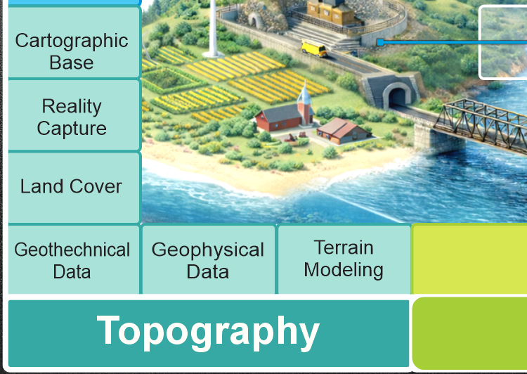
Core Components of the Topography Domain
The topography domain integrates the essential elements required to represent terrain and physical space, including:
- Cartographic foundations and spatial reference
Coordinate systems, geodetic frameworks, and spatial reference models ensuring positional consistency. - Terrain modeling and surface analysis
Digital terrain models, slope, aspect, visibility, and morphologic analysis supporting design and risk evaluation. - Reality capture for territorial modeling
LiDAR, photogrammetry, remote sensing, and field surveys used to observe and update physical conditions. - Land cover and environmental mapping
Classification of surface features, vegetation, and environmental conditions influencing planning and analysis. - Geotechnical and subsurface data interpretation
Soil, stratigraphy, and subsurface conditions supporting stability, construction, and infrastructure design. - Integrated terrain data management
Harmonization of multi-source terrain data into consistent and reusable representations.
Together, these components ensure that Digital Twins remain physically grounded and spatially coherent.
Topography as a Cross-Domain Enabler
Topography underpins all other territorial domains:
- Governance, by defining parcel geometry and spatial reference
- Hydrology, by controlling flow paths, accumulation, and watershed behavior
- Mobility and utilities, by constraining alignment, gradients, and constructability
- Buildings, by influencing site conditions and foundation design
Without reliable topography, Digital Twins may be legally valid or analytically complex, but remain physically unreliable.
From Terrain Models to Digital Twins
In TwinGEO, topography is not treated as static background data.
It becomes part of an operational Digital Twin when:
- terrain representations are continuously updated through observation
- surface and subsurface conditions are linked to assets and processes
- terrain analysis supports scenario evaluation and decision-making
This allows Digital Twins to assess:
- development feasibility
- infrastructure risk and cost
- environmental impact
- long-term territorial change
Domains as Systems, Not Categories
TwinGEO domains are not software groupings or technical datasets.
They are real-world system families that structure Digital Twin development across disciplines, lifecycles, and decision contexts.
Each domain contributes essential assets, processes, and observation pathways toward integrated territorial Digital Twin Systems.