Virtual Earth updates images (Nov 07)
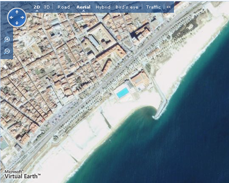
With great satisfaction we see the update of High resolution satellite images in the month of November, in Virtual Earth, The image shows Mataró, where there was no image of this quality.

These are the updated Spanish speaking locations:
(Bird's Eye) Spain:
If you do not save your changes before sending your comments, please enable javascript to add a link to this page. If you are the owner of this Company CLICK HERE and log in.
(GeoEye) Ortofotos Satelitales
La Palma, Tenerife, Zaragoza, Island Ibiza Island, (Spain)
Chichen_Itza, Monterrey, Acapulco (Mexico)
Isla San Andres Island, Isla Providencia (In front of Nicaragua)
Sao Paulo, Rio de Janeiro (Brazil)
Buenos Aires, Argentina
Cuzco (Nor West), Lima (Peru)
Islands to the East (Chile)
Northeast (French Guiana)
Tropical Destinations:
Havana Cuba)
Roatán, Honduras
City Belize, Belize
Antigua, Guatemala
Bermuda, Bridgetown, Saint Martin, St Lucia, Dominica, Saint Vincent and the Grenadines, Grenada, Trinidad and Tobago, Netherlands Antilles, Aruba, Little Caiman, American Samoa ... and others (In the Caribbean and Antilles)
Remember that if you want to compare the images of Google Earth and Virtual Earth Here we explain how.


