
kml
-
Google earth / maps

How to raise 3D buildings in Google Earth
Many of us know the Google Earth tool, and that is why in recent years we have witnessed its interesting evolution, to provide us with increasingly effective solutions in line with technological advances. This tool is commonly used...
Read More » -
Google earth / maps

View UTM coordinates in Google Maps and Street View – using AppScript on Google Spreadsheet
This is an exercise developed with students from a Google Scripts course carried out by the AulaGEO Academy, with the aim of demonstrating the possibilities of applying development to the well-known Geofumadas Templates. Requirement 1. Download a template of…
Read More » -
Google earth / maps

Get altitudes of a route in Google Earth
When we draw a route in Google Earth, it is possible to see its elevation in the application. But when we download the file, it only brings its latitude and longitude coordinates. Altitude is always zero. In this article we will see how to add to this…
Read More » -
Featured

How to download images from Google Earth - Google Maps - Bing - ArcGIS Imagery and other sources
For many of the analysts, who want to build maps where some raster reference from any platform such as Google, Bing or ArcGIS Imagery is displayed, surely we do not have a problem because almost any platform has access to these services. But…
Read More » -
Google earth / maps

Download maps and plan a route using BBBike
BBBike is an application whose main objective is to provide a route planner to travel, using a bicycle, through a city and its surroundings. How do we create our route planner? Indeed, if we enter your website, the first thing that…
Read More » -
AutoCAD-AutoDesk

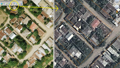
My experience using Google Earth for Cadastre
I frequently see the same questions in the keywords by which users arrive at Geofumadas from the Google search engine. Can I make a cadastre using Google Earth? How accurate are Google Earth images? Because my…
Read More » -
Downloads

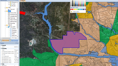
View Google Earth coordinates in Excel - and convert them to UTM
I have data in Google Earth, and I want to display the coordinates in Excel. As you can see, it is a field with 7 vertices and a house with four vertices. Save Google Earth data. To download this data, do…
Read More » -
Geospatial - GIS

Open shp files with Google Earth
The version of Google Earth Pro stopped being paid for a long time ago, with which it is possible to open different GIS and Raster files directly from the application. We understand that there are different ways to send a SHP file to…
Read More » -
AutoCAD-AutoDesk
Spatial Manager: Manage spatial data efficiently even from AutoCAD
Spatial Manager is an application for spatial data management, which works independently. It also has a plugin that gives geospatial capabilities to AutoCAD.
Read More » -
Cadastre
Sync Microstation with Google Earth
Google Earth has become an almost unavoidable tool in our current cartographic processes. Although it has its limitations and as a result of its ease many perversions are commented every day, we owe this tool that geolocation and…
Read More » -
Geospatial - GIS

CartoDB, the best for creating online maps
CartoDB is one of the most interesting applications developed for creating attractive online maps in a very short time. Mounted on PostGIS and PostgreSQL, ready to use, it is one of the best I have seen... and it is a...
Read More » -
Google earth / maps

OkMap, best for creating and editing GPS maps. GRATUITOUS
OkMap is perhaps one of the most robust programs for building, editing and managing GPS maps. And its most important attribute: It's Free. We have all seen ourselves at some point in the need to configure a map, georeference a…
Read More » -
Geospatial - GIS

SuperGIS Desktop, some comparisons ...
SuperGIS is part of the Supergeo model that I spoke about a few days ago, with good success in the Asian continent. After trying it out, here are some of the impressions I've gotten. In general, it does almost what any other…
Read More » -
GPS / Equipment

Posify, low-cost GPS centimetric accuracy
This product was recently presented at the ESRI Users' Conference in Spain, just last week and this next week they will be at the TopCart in Madrid. It is a GPS positioning and measurement system that…
Read More » -
innovations

The Trans 450, Rapid Transit Bus for Tegucigalpa
This is an interesting project that is now being developed in Honduras, under the Rapid Transit Bus (BTR) modality. Although now it is in that stage of understanding before the carriers who do not have the clarity of how they evolve...
Read More » -
Downloads

Export list of geographic coordinates to Google Earth, from Excel, with image and rich text
This is an example of how Excel can send content to Google Earth. The case is this: We have a list of coordinates in decimal geographic format (lat/lon). We want to send to Google Earth, and we want the…
Read More » -
Downloads

Excel to Google Earth, from UTM coordinates
Let's see the case: I have gone to the field to build a property, as shown in the following table and I want to visualize it in Google Earth, including a couple of photos that I have taken The genius of the template is that…
Read More » -
Google earth / maps

How to insert local images in Google Earth
Responding to some doubts that come to me, I take the opportunity to leave the result for public use. Some time ago I had talked about how you can insert images linked to a Google Earth point, although using web addresses. In this case I want...
Read More »