
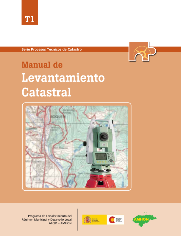
Manual of cadastral survey
Access the Geofumadas virtual disk to download the PDF file [paiddownloads id=”35″]
Cadastral surveying
Access the Geofumadas virtual disk to download the PDF file [paiddownloads id=”35″]
automated PDF extract
Program to Strengthen Municipal Regime and Local Development in Honduras.
Manual of Cadastral Survey. No. 1, Series Processes
Cadastre Technicians. Tegucigalpa, Honduras. 2009
74 pages.
Cadastre / Field Survey / Surveying.
© Copyright 2009
Program Strengthening the Municipal Regime and Local Development in Honduras.
Col. Palmira. Calle República Colombia. No. 2315. 5242 Post Office, Tegucigalpa, Honduras.
Tel. 232-2344, 232-2247
E-mail. pfm@aecid.hn
Document prepared by: Pablo Javier Cruz
Technical Coordination: Golgi Darío Alvarez
Address and Edition: M.Sc. Alma Maribel Suazo Madrid,
Coordinator PFM / AECID / AMHON.
Printing: 500 copies
Partial or total reproduction is authorized for purposes of study, disclosure, application or replication, provided the source is cited.
Contents
About Us | 5
Chapter 1
Chapter 2
Chapter 3
Chapter 4
Preliminary considerations | 7
Survey methods | 7
Process of cadastral survey | 8
Execution of the survey | 15
Delineación predial | 15
Field Reports | 22
Post processing of data | 23
Cadastral zoning | 23
Digital Archive Organization | 25
Vectorization of maps | 25
Organization of the fiches | 31
Closing Activities | 33
Administrative Closing | 33
Privacy Policy | 34
Attachments | 37
The Municipal Strengthening Program, with the financial support of the Spanish Agency for Development Cooperation and implemented by the Association of Municipalities of Honduras (AMHON), is promoting a project in five Honduran communities, which seeks to improve the living conditions of the inhabitants, through local governments as responsible for managing their own development. Direct intervention in the municipalities includes three main strengthening components:
▶ Municipal Finance
▶ Territorial management and
▶ Local economic development.
The impact of these components is strengthened through the support of the union body of the municipalities (AMHON) and the municipalities, with which processes are carried out to strengthen municipal autonomy, cohesion capacities and coordination with different cooperation initiatives within the same theme.
Within the component of Territorial Management, the multipurpose cadastre is promoted as an instrument for development, under the premise that by applying it in its different purposes, the municipality can increase its collection, offer better services, grant full domains within its competence and plan better. the use of the land. In addition, the residents benefit from the legal security of their land, the return of their taxes on social works and the integration of territorial order within the development plans.
As a contribution to promote the continuity of the efforts promoted, a systematization plan was created that contains different products, in the case of cadastre, it includes the manuals for its implementation, grouped into three series: Cadastral Technical Processes, Cadastral Technological Processes and Cadastral Administrative Processes.
This document, "Cadastral Survey Manual", is part of the Cadastral Technical Processes series, and contains the procedures to obtain the necessary geometric information in the field, to construct the maps in digital format.
The manuals are part of the series:
▶ Cadastral Survey
▶ Urban Valuation
▶ Rural Valuation
▶ Non-Digital Maintenance
▶ Planning in Cadastre
▶ Staff Training
At the end of the document are included some annexes related to the survey, including a survey guide using total station. This is an example of how specific practical guides should be developed for different instruments, methods, and processes of this document, some of which are being promoted by projects that jointly with the Property Institute carry out cadastral survey.
Alma Maribel Suazo
Coordinator of the Program for Strengthening Municipal Regime and Local Development, AECID-AMHON
Chapter 1
Considerations
The cadastral survey includes different related activities such as filling in the cadastral record, urban valuation, digital mapping, etc. Due to its extension, the treatment of each one of the subjects has been developed separately in several manuals that form part of the production of the PFM. This manual refers to aspects related to measurement and citing, prioritizing the approach for urban purposes, although its application is similar with
rural purposes. It constitutes a starting point for the necessary deepening of the subject.
Methods of survey for urban measurement
Areas of municipalities where human settlements exist are known as urban areas, including municipal headwaters and more populated villages. In these areas survey methods are used to ensure greater accuracy, due to legal aspects, urban planning and multiple purposes that can be surveyed, such as the design of sewage systems or improvement of the road network.
For these zones, methods based on the use of topographic and global positioning equipment with high levels of precision are used. They are generally referred to as direct methods.
Methods of survey for rural measurement
In rural areas, there is no population concentration; the lands are generally of agroforestry use, with large dimensions in comparison with the urban area; and with topography or vegetation that hinders access. For these reasons, they are interested in methods that allow the greatest coverage of the survey, sacrificing accuracy.
For these zones, methods based on the interpretation of aerial photographs, satellite images or products resulting from their treatment, known as orthophotos or orthorectified images, are used. They are known as indirect methods.
Combination of methods
In both urban and rural areas, it requires the combination of instruments and support of commonly used equipment such as tape measure and compass. Likewise, a photointerpretation survey can be aided by the use of direct surveying equipment in areas where it is not possible to obtain sufficient detail or in case the grounds are too small.
Process of cadastral survey
The cadastral survey includes several stages, depending on the method used can be renamed. But, in general, all have a sequence that involves the capture of data in the field, its processing in cabinet by computer programs, and its subsequent validation with the population.
For purposes of this manual, the urban survey includes the following stages:
▶ Building delineation
▶ Filling the plug
▶ Data digitization
▶ Closing Activities
It is denominated predial delineation to the capture of geometric data of the plots in the field. This activity is conditioned by the method applied, the type of instrument that counts the municipality, and the priority that is sought with the measurement. An important attribute in delineation is the precision required. To guarantee this accuracy in urban areas the following direct survey methods are suggested:
▶ Lifting with total station.
▶ GPS survey and differential correction. Both methods allow delineating the blocks or
apples by the contour or in their vertices; but it is always necessary to combine the method with the use of the tape measure to measure the premises internally.
These methods have been tested, with good results and profitability, in the municipalities where the PFM is covered. Other methods used for urban delineation range from metric measurement and compass (low cost and precision) to photointerpretation (high cost and low accuracy for urban purposes).
1 Image | Survey with total station
2 Image | GPS surveying
Technology Precision Minimal gang Rend. Approx.
Total station Excellent 3 technicians 30 building / day
GPS with differential correction
Good 2 20 technicians building / day
Knowing each method of surveying and its limitations allows to adequately supervise the field work and assess its quality objectively.
To fill the tab is always applied the visit in field property by land, picking up the necessary characteristics that determine its value and possession. A valuation technician could raise about six cadastral tokens daily including cabinet calculations (3 image).
In addition, the digitization work is required in the office, that is, having a technician who has the necessary computer skills to carry out the mapping, to support the fieldwork and registration of the files in the financial system of the municipality.
It is recommended the formation of teams consisting of delineators, technical appraisers, and a digitizer.
At the end of the work, a process of quality control and validation of information with the population is necessary. For this administrative views or public exhibitions are made in which the inhabitants have the opportunity to verify their information.
List of equipment and supplies for the field work
The equipment listed below is an example of requirements for a mass lift (see Equipment Care Manual).
▶ Topographic equipment (total station or GPS with differential correction).
▶ Tape measure of 30 m.
▶ Compasses.
▶ Field books.
▶ Pre-enumerated urban cadastral records.
▶ Scalers.
▶ Boards.
▶ Scientific calculators.
▶ Sets of squares.
▶ Backpacks.
3 Image | filling in the cadastral form
List of equipment and supplies for cabinet work
▶ Personal computer.
▶ Map sheets, aerial or satellite images
of the area in digital format, maps of legal nature of the land.
▶ CAD software for mapping.
▶ Printer (capable of tabloid paper
preferably).
▶ Letter and tabloid paper.
▶ Folder or folder size legal or trade.
▶ Catalog of current values.
▶ Manual of urban delineation and valuation of
the General Directorate of Cadastre and Geography
(DGCG).
Control and supervision plan
The role of the cadastral manager and his assistant in an urban survey project focuses on the supervision of the field and cabinet processes, guaranteeing the quality of the product in terms of accuracy, accuracy and delivery time. The project can be executed by the municipality directly or by subcontracting services.
It needs to prepare a project control plan to facilitate the supervision process, which is made known in advance to the executors and the municipal corporation.
This plan should include, but not be limited to:
▶ Schedule with important dates and events
(milestones) defined (4 image).
▶ Responsibilities.
▶ Attempts to inspect the work of
field, cabinet and reports.
4 Image | Schedule of activities
▶ Quality indicators or criteria for assessing the
product.
▶ Specifications and payment dates to the executors,
usually against sequential products and reports.
This plan is useful when presenting progress reports to the municipal corporation, explaining causes of backlog or detecting needs before they become obstacles to the proper execution of the project (see Cadastre Planning Manual).
Socialization of the project
Socialization is an important point for the success of the cadastral survey.
The massive update of the cadastre requires the entry of field crews to each of the properties in the coverage area. In addition, the taxpayer must answer some questions that may show reluctance or distrust. Thus, the collaboration of the population is a key factor in this type of projects.
The Municipal Corporation must design and adopt a socialization strategy, involving key actors of civil society in the project. The actions of this strategy must be present before, during and after the project to ensure the successful implementation of the cadastre.
The head of cadastre, as public authority, assumes the role of mediator between the executor and the population during the execution of the survey, and reports the events to the Municipal Corporation.
The 1 graph reflects the different processes of the implementation of the municipal cadastre and its relations with other activities.
At t he ri ss of organized soci ety:
• Provide support and safety to
field crews.
• Keep the population informed.
Art. 55 Property Law
All real property within the territory of the Republic of Honduras must be registered. The owners of these properties have the obligation to provide the necessary information and the free assistance that is required for the fulfillment of this purpose.
1 Chart | Cadastral survey and its influences
Municipal Supervision
• Dept. of Cadastre
• Municipal Corporation
Other stakeholders
• Cooperators
• Government
Catastrophic values
Cadastral File Field Sketch
Recovery of cadastres
Organization
in folders
Map
Stage
closure
Confidential Information
fiscal and financial
SIG
SAFT-SIG Integration
Perimeters
Pressures from the social sector
• Civil associations
• Private company
Chapter 2
Execution
The mass measurement and valuation of properties involves, for the cadastre department, to appropriately manage the activities and products at each stage, which requires specific technical skills and project progress management.
This chapter presents basic information for the execution of each of the processes and best practices to maintain a quality standard on the chart and on the map.
Building delineation
This is the name by which the measurement of land is known by direct or indirect means; it is realized in 2 not necessarily sequential stages: the delineation of the blocks (map manzanero) and the delineation of the properties (land map), that can be realized in parallel form if the resources allow it.
Map of manzanero
Through this map you get the physical characteristics that allow you to reconstruct the apples graphically on the map. It does not require the technicians to enter the premises, and their execution or uprising entails minor difficulties.
Art. 68, Property Law:
The cadastral map linked to zoning of territorial order, in which the buildings for public use are defined, constitutes a title in favor of the State or the municipality, as the case may be.
A. Survey with total station (figure 1)
The total station is an electronic equipment similar to a theodolite, but with the capacity to obtain information with high precision. There are different models, but all allow the download of data in digital form. This simplifies the preparation of maps and, in combination with a GPS, produces georeferenced information (for more information, a full station use guide is included in the annex section).
The objective is to make observations to each vertex of the front of the lots that adjoin the street and mark the divisions between the lots.
The simplified procedure is as follows:
▶ Obtain with GPS the precise coordinates of two control points (BS and P1 in figure 1). This is to achieve a georeferenced survey.
▶ The unit is located in P1 and continues to move along the central axis of the street (P2, P3, etc.); since
Figure 1 | Survey with total station
P1
BS
each location is taken at the front of each batch, so that the correct shape of the apples can be delineated and, simultaneously, a sketch is drawn in a field notebook similar to the one shown in figure 1.
▶ Data is downloaded to a computer via interface software, and the responsible technician can digitize the map according to the field map.
In figure 1, BS represents the reference control point (Back Sight). P1 represents the topographic control point where the device is located, and the largest number of observations are taken from that location (red lines) including the P2, which will be the new control point where the device will move and so on.
Block
Calle
Block
Block
P2
Block
P3
B. Survey with GPS
and differential correction
The objective is to mark so many points of good topographic quality that allow the subsequent digitization of the geometry of the blocks, it is required the application of differential correction techniques to minimize the typical errors of the GPS system.
You can use two methods for field survey:
Block delineation: considers the block as a single site, takes observations at each of its vertices for later digitization. The simplified field procedure is as follows:
1. Place and enable the base in a safe and clear place, it must remain operating during the time it takes to perform the survey.
2. Scroll with the rover taking observations at each vertex of the block, consider it as a single property. In order to reach the best specifications, take into account the recommendations of the manufacturer or the practical guide developed for these purposes.
3. Simultaneously make a sketch showing the geometry of the blocks and points marked with GPS, with their respective numbering (05 image).
4. The data are downloaded to a computer using interface software for digitizing according to the field sketch.
Mooring or control points: points are marked on the central axis of the street, and moorings are made with tape measure and compass to reconstruct the geometry of the blocks.
1. Place and enable the base in a safe and clear place, it must remain operating during the time it takes to perform the survey.
It is called post-processing to the correction of data captured by a rover, based on data captured by a fixed GPS (base), which has been obtaining data at the same time and in the same working area.
The differential correction is measured by a GPS with sub-metric capability, the use of 2 appliances (1 fixed base and 1 rover) is required. Accuracy is less than 1 meter.
5 Image | Field geometry sketch of blocks raised with GPS Image
2. Make durable marks at strategic points of control on the axis of the street, usually at street crossings or at intermediate points where there are major breaks; and get the precise coordinates of each point with GPS.
3. Use the tape measure and compass to make moorings with triangulation of distances and directions towards the vertices of the blocks (image 6 and 7).
4. Simultaneously draw up a sketch showing the geometry of the blocks, the control points marked with GPS with their respective numbering and the moorings made.
5. The data are downloaded to a computer using interface software for digitization according to the field sketch.
Both methods are reliable. The product of this activity is the complete manzanero map with a preliminary numbering. This map is indispensable to elaborate the building map.
Building map
In order to delineate the farms, the use of tape measure is required to take the measure of each boundary. The elaboration of this map has difficulties like having to enter all the premises (with the consent of the owner). In addition, constructions and vegetation hamper measurements. It requires the ability and ability of technicians to solve these problems in the field and meet production goals.
The procedure can be defined as follows:
1. With the participation of two technicians the tape measure is extended on each boundary of the property internally and its length is defined.
6 Image | Mooring or control point sketching with GPS and tape measure (see Delineation Manual).
7 Image | When measuring, hold the tape horizontally and do not exceed 20 meters in each measurement.
2. Make moorings by means of triangulation or course in strategic points that facilitate to the technician the digitization of the same, especially in breaks or important internal vertices.
3. Draw a sketch of each measurement made showing the correct geometry of the buildings; if possible, ensure that the entire block fits into one sheet and assign a temporary number to each (8 image).
4. Write in the sketch the location of important references such as churches, schools, businesses, etc. These are useful for the mapping of social and commercial equipment. You must also enter the name of the owner for the match with the chips.
You can find extensive and detailed information in the Urban Delineation Manual (DGCG, 1992).
The urban cadastral file
The cadastral record is the ballot containing the alphanumeric data of the survey. There are different versions, but for municipal purposes has been applied with good results the file validated by the Executive Directorate of Cadastre (DEC), and now is the General Directorate of Cadastre and Geography (DGCG), belonging to the Institute of Property.
The manuals on urban valuation and rural valuation of this compendium explain in detail the filling of each field of the sheet. This section indicates, in a general way, the sections of the file that must be filled in case of a survey, in which the assessment is not done in parallel (practice not ideal).
In the field crews must participate a technician trained in urban valuation, who visit each plot and interview the owners to fill in the chips that are needed:
8 Image | Building sketches in fields
9 Image | Filling the form
You must fill in the form on the property with graphite pencil and capital letter, while interviewing the owner
▶ One main cadastral data sheet per plot, where
may include data from the first floor of the main building.
▶ An additional card for each floor or additional building on the property.
The contents of the tab are divided into extensions or blocks that collect important data information in related fields.
General data (figure 2).
Fill in the information of each box according to the data provided by the owner or, failing that, the informant. Take special care with cadastral key data, owner's name, identity number, housing code and tax status, for their involvement in determining the real estate tax.
Figure 2 | Map of page 1
General data
Housing Code Cadastral Key
Owners
Tax status
General delineation data (figure 3).
To complete this information, check the documents of possession of the property and verify the type of domain and the area of the registered parcel. If for some reason you do not get this data, write it down in comments.
Figure 3 | Map of page 1
General delineation data
Registered area
Possession or dominion
Comments
Proindividual property and building control
(Figure 4).
This control is useful when in the same plot there are several owners or when there are one or more buildings. Be careful when filling the fields of number of buildings, number of buildings inhabited, calculation date and calculator, as they relate to the valuation of improvements.
Figure 4 | Map of page 1
Proidivisa property
building control
No buildings
No. inhabited buildings
Calculation and calculation date
Field Reports
The easiest way to perform reports is to use standard formats that feed periodically with field data. Two different formats are required to serve their purposes.
List of owners
Its objective is to provide a summary of the properties that are located in each block, extracting the most relevant information for an internal control. There are no fixed rules, but the following are considered basic data:
▶ Cadastral number (mapping)
▶ Owner
▶ Identity
▶ Land area (mapping)
▶ Value of the land
▶ Value of improvements
▶ Taxable value
▶ Tax payable
Field reports have two purposes:
• Orderly data control.
• Production reports.
1 Diagram | Integrated report
Report gang
2
Generally, these data are complemented once the cabinet process has been carried out, where it is obtained by manual calculations or by means of a computer system, the evaluation and tax information.
Report gang
1
Supervisor integrated report
Report gang
2
Production formats
These formats are the evidence and support for the preparation of progress reports, hence their importance. They can cover weekly or monthly periods and report the results obtained by the field team with basic indicators defined as:
▶ Outlined blocks
▶ Outlined buildings
▶ Polls
Then, the field supervisor integrates the production of all teams in the same report (1 diagram); In addition, you must add an analysis that includes the following:
▶ Quality control records.
▶ Incidents or problems
during the work and recommendation to solve them.
Chapter 3
Post-processing of data
After the field survey, the information must be processed in the cabinet. Post-processing is called that activity which includes the download of GPS data, the total station, and digital mapping.
This section includes basic aspects of post-processing, is useful for technicians who download data and primitive maps (see Digital Mapping Manual).
Cadastral Zoning
Zoning is the procedure by which the estates are grouped based on criteria; its purpose is to facilitate the administration of data before, during and after the survey. There are several of them, but the ones mentioned below are those used in Honduras, generally applied for the definition of cadastral keys:
Quadrants to scale: is a type of zoning that has as final objective the division of the territory into segments, which can be printed in planes under the same scale (10 image). Its advantage is that it can be linked to the cartographic division of the National Geographic Institute, dividing into uniform segments of degrees, minutes or seconds in equal sizes. This model is used by many countries and in municipalities was implemented by
10 Image | Zoning of buildings by quadrant map
the Executive Directorate of Cadastre (Now DGCG), with formats 1: 10,000 for rural and 1: 1,000 for urban.
It has the disadvantage that the map generated for printing purposes is not the same where the original modifications are made, since the borders are broken. However, it is very practical to be used in printed format for the continuity of the territory.
Sectors: this type of zoning is driven under the influence of technology in the cadastre; is to define the sector, delimited by a number of plots that fit within an imaginary framework of similar size. Although they are within a similar frame of reference, criteria such as delimitation on natural edges such as rivers, or artificial ones such as streets, should be respected, resulting in irregular shape of the sectors. It has the difficulty that some buildings are larger than the frame, which breaks the rule.
They can be printed on similar scales, but it presents the difficulty of having to do an additional work in the construction of the marginal information and adjoining maps. This model is used in different countries, in Honduras it has been promoted by the Land Management Program (PATH), in the implementation of the Unified System of Registers (SURE), with 1 formats: 5,000 for rural and 1: 1,000 for urban image 11). The Law of Property states that SURE is an official system for the management of cadastral information.
This criterion can be applied to the quadrant format, if the sector is created from the numbered plots based on the map; in this way both could have a close equivalent, but it would be necessary to unify exceptions to the rule in both cases.
Zones: other criteria called with the name zone, have been applied in Honduras, using as
11 Image | Zoning of estates by sector
reference the neighborhood or colony (12 image). They present the difficulty that their shape and dimension is not uniform, requiring additional work to print maps at equivalent scales.
Organization
digital archive
To standardize the handling of the digital data, it is recommended that the mapping technician create the following structure on the C disk of the computer assigned to the post-processing (13 image).
C: / Cadastre "Municipality" (General folder).
▶ References (CAD or support raster files).
▶ Documents (reports, minutes, etc.).
▶ Final maps (in print format).
Map Vectorization
This activity consists in performing the digital mapping of land sketches and field manzaneros, in order to faithfully represent their dimensions and geometry. It can be divided into four processes:
▶ Cadastral mesh
▶ Vectorization of map manzanero
▶ Vector mapping
▶ 1 final mapping: 1,000 and 1: 10,000
It requires a technician trained in the use of CAD software (Microstation Geographics, AutoCAD, etc.), who can apply different methods that depend basically on the technique used during the field survey and implicit in the sketch drawn by the delineators (see Manual Digital Mapping).
12 Image | Sector adapted to the criterion of quadrant
13 Image | File organization
(folders)
This section explains these procedures, as they are basic aspects that must be mastered by survey technicians. The criterion used in these manuals is the one of the zoning by quadrants to scale, since it is a method used by many municipalities and made official by the DEC at the moment of implementing it.
It is up to the Property Institute to standardize, document, formalize and accompany the change of this type of criteria, since most municipalities that use financial management systems are adapted to this format.
Construction of the cadastral reticula
(mesh)
New file:
In Microstation create a new file called Malla (Municipality) and save it in the folder c: / Cadastre (Municipality), create the levels:
▶ Rural map
▶ Urban map
▶ Name of rural map
▶ Urban map name
Rural map:
1. Take the INA rural map (digital or analogue) with coverage in the survey area, and verify the existence and legibility of the four marginal coordinates at their corners.
2. Activate the Rural Map and use the Point Active Point tool and enter the coordinate of the four corners of the map in the Key In bar.
3. Use the line drawing tool (Place Smart Line) to close the contour of the map by clicking on each drawn point.
4. Activate the Rural Map Name level and, using the text tool (Text), type the name of the map to locate it in the center of the box. Ex: IR23 (14 image).
Street map:
1. Activate the Urban Map level, and use the line tool to divide the rural quadrant into four quadrants from the midpoint of your lines.
2. Now divide each quadrant into 25 quadrants forming a mesh that divides into five vertical parts and five horizontal each of the quadrants. Use the Construct Point tool between Data Points (from the Main bar) to place exact marks that will guide the cuts over the vertices of the quadrant.
3. Activate the Urban Map Name level and type the letter of the urban map that identifies it and place it in the center of each box. Ex: "A" (15 image). Refer to the Non-Digital Maintenance Manual for information on forming the cadastral number.
Vectorization of map manzanero
It is the basis for elaborating the building map, in which it is preliminarily defined the numbering of the blocks (16 image).
1 In Microstation create a new file with the name of "Cadastre (Municipality)" (ex: Cadastre Macuelizo) in the folder c: / Catastro Municipality.
2. From the Level Manager create the necessary levels with the attributes specified in the attachments of this document.
14 Image | 1 Rural Mesh: 10,000
15 Image | 1 Urban Mesh: 1,000
16 Image | Map of manzanero
3. Activate the Apple Tree Level and vectorize them according to the field sketch by applying one or more appropriate methods according to the Digital Mapping Manual.
4. For numbering activate the Apple Number level and use the Place Text text tool and place the respective number in the middle of the apple. Use a value of two in the height and width of text (High / Width). Refer to the Digital Maintenance Manual to understand block numbering.
5. Circle 1.5 around the Apple Number to highlight it and avoid confusion with other information.
Vectorization of building map
This map defines the final numbering of apples and farms to complete the cadastral number.
1. Open the file Cadastre Municipal.dgn to cotinuar the vectorization of farms.
2. Activate the Landholding level and vectorize them according to the field sketch, apply one or more appropriate methods as explained in the Digital Mapping Manual.
3. For numbering activate the Property Number level, use the Place Text text tool and place the respective number in the middle of the property. Use an 1.5 value in the height and width of text (High / Width). Refer to the Digital Maintenance Manual to understand land numbering and the Non-Digital Maintenance Manual to understand cadastral number conformation.
4. In the Level Display, activate the Predio level,
and hold the icon on the Main bar
measure distances to select the icon
Measure Area (1 icon and 17 image).
▶ In the displayed box, verify that Method is in the Flood option.
▶ Click inside the property so that the program shows the area to calculate (highlighting it) and another click to get its value.
▶ The result of the measurement is displayed on the display or at the bottom of the display.
To copy the area on the property do the following:
1. Double-click the box on the value of the property area to select it.
2. Perform the Control + C (Copy) and Control + V (Paste) key combination and place the text inside the property without interfering with the location of your number. Set a text size of
2 (High / Width).
3. Make an impression of each block (one per page), including the name of the map to which it belongs, block numbering and land with its calculated area. These impressions are delivered to the valuation technicians to complete the information of the chips (18 image).
1: 1,000 final mapping
Once the mapping is completed, the final maps are prepared in print format, as long as there are no pending modifications of any land or nomenclature.
Export File
1. Apply a complete topological cleaning to the entire map (see the Digital Mapping Manual).
2. Insert the cadastral grid as a reference and place a Shape-Clip Fence around the
1 Icon | Measure Area
17 Image | Measure Area
18 Image | Areas of plots on land map
first quadrant of urban map by clicking on its vertices.
3. In the Key-In type the Fence File command and in the open dialog you are prompted for a name and address to save the quadrant as a separate file. Use the name of the same urban map and save it in the folder c: / Cadastre Municipality / Final Maps.
4. Repeat this procedure for each quadrant of the entire map.
Frame with coordinates
1. Open this new file and place a grid with geographic coordinates around it with the Grid Generation tool (from the Tools-
Coordinate System-Coordinate System).
2. When deploying the Grid Generator table configure the size and location of the coordinates to your liking, and save this arrangement with the name "Frame with 1-1000 Coordinates" at the address proposed by the program.
3. Press Neat Line-Grid Generation and click on each corner of the on-screen map, then press Generate (19 image).
Print format
The format must be pre-designed with logos and marginal data. These are stored as cells or blocks that can be reused and edited to fit the information of your municipality.
1. Use the Place Active Cell tool and in the open dialog, locate and open the 1-1000 Urban Maps Format file, then select the one that corresponds to your municipality.
19 Image | Map image with coordinates
2. Insert the module on the urban quadrant and edit the marginal data such as map name, coordinates, date, etc.
3. Select the entire map and group it from the Edit-Group menu (20 image).
Organization of the tokens
Before passing the cadastral records to the next process, you must organize them according to the block and the map to which they belong (21 image).
1. Finish filling the fields of the tab that depend on the mapping: cadastral key, adjoining areas and land area.
2. Staple the additional tabs behind their respective main tab.
3. Take all the tiles corresponding to the same block and place them in the same folder or folder. Write on the cover the name of the map and block.
4. Join the owners list and printed map of the block and put them on the back cover of the folder, this allows you to see a summary of the files it contains and prevents the loss of valuable information by misplacing the file.
5. Check each folder to ensure that the tabs contained match the owner's listing and printed map.
6. Gather all the folders that belong to the same map and place a paper ribbon around them to keep them together; and proceed to delivery.
20 Image | Map with coordinates and format
21 Image | Organized folder to deliver
Chapter 4
The closing of a cadastral survey includes two stages aimed at giving legality to the process to culminate it successfully, first the administrative closure is done and then the public hearings.
The land registry manager must consider these legal and formal requirements to receive the product and officially terminate the process.
Administrative closure
It consists of preparing the information for delivery to the head of cadastre on behalf of the Municipality. If the survey phases were carried out as described here, only a conformity review is required to complete the project.
Summary of information generated
▶ Use MS Excel to complete the generated summary information format (see annexes) to present a summary inventory of how many lots, tokens, and cadastral maps were raised (22 image).
22 Image | Summary information format
▶ In the same format compare the projected goal
and executed. Update the included graphs for better visualization.
▶ This information must be validated and reviewed by the head of cadastre prior to delivery. It is recommended that it be also signed by the head of tax control and municipal auditor.
Delivery record
▶ Use the Delivery Record format (see annexes) to describe the product obtained from the process and some important observations (23 image).
This document guarantees the execution of the project and ends the administrative closure.
Public Views
This is an administrative procedure that consists of presenting the maps and records to the community and interested parties to show their agreement or not with the data on their property. The purpose is to comply with the formal provisions of the cadastre to purge the information before declaring it true. This process is carried out in conjunction with the Property Institute.
▶ The head of the cadastre must submit the results of the mass update before the plenary of the Municipal Corporation (if possible in open town hall), providing the information requested in this regard.
▶ The Municipal Corporation must call public hearings on a specific date, record it in the minutes, and delegate the responsibilities and resources that are required.
▶ It is necessary the formation of a support team with the participation of regidores and personnel of
23 Image | Final delivery record
The Property Law makes it possible for the Institute of Property (IP) to carry out public hearings as a requiem for the declaration in the officially registered zone. If the interested party does not present opposition during the 30 days after the first notice, the data will be considered as valid.
the cadastre departments, tax control and audit to carry out the logistics and coordination actions of such event.
▶ An announcement is made by the appropriate media (radio, press, bulletins, etc.), calling the owners of the area to present at a date and place established to validate the information collected during the survey.
▶ The Municipality establishes the date and place of the call within the registered area to facilitate the influx of stakeholders and the work of rectifications in the field.
▶ In public hearings, technical staff and sufficient resources should be available to deal with public inquiries and complaints.
▶ The duration of public views is 30 calendar days to allow sufficient time for foreign owners to review.
▶ Taxpayers must present the possession documents that prove their property, they must complete the missing domain data in the cadastral file.
▶ Once the validity period has expired, the public hearing is closed and the data will be considered valid for cadastral purposes.
It is normal that the fear of tax burdens provoke complaints and disagreements between the technical opinion and the opinion of a neighbor regarding the references of their property. In these cases you should do a review of the data and calculations to detect errors or omissions. However, it can not modify the tax or grant exclusive benefits or discounts to a taxpayer if that goes against what is established in the Plan of Arbitrios and the Law of Municipalities; the opposite generates administrative responsibility.
The Government's decentralized cnmittee omitting a ccnnnent has not set up its own cadastre and will make it available to the Property Institute (IP) within a period of 30 days from the date of notification corresponding, in order to start the integration process to register cadastral information (Art.62, Property Law).
Attachments
• List of levels or layers for cadastral maps
• Delivery record
• File delivery summary
• Practical guide: Cadastral surveys with total station SET520K SOKKIA
37 Cadastral Survey Manual
Annex 1: List of levels for cadastral maps
Parameters to implement in mapping
For the digitization of farms the following levels and characteristics are created.
Level Line Type
Line Color
Weight of
Feature line to put
GPS points 0 (continued) 2 (green) 3 -
0 property line (continued) 9 (gray) 0 Land property line (cadastral)
Apple line
0 (continued) 4 (yellow) 0 Landmark (cadastral)
References 0 (Continued) 0 (White) 0 - Area 0 (Continued) 5 (Magenta) 0 -
Land use line
Rural property number
Current use number
Well national code
High voltage line
High tower
Tension
2 (dotted) 3 (red) 0 Line of land use (land use)
0 (continued) 9 (gray) 0 Num. Rural property 1: 1000 (cadastral)
0 (continued) 3 (red) 0 Land use code (land use)
0 (continued) 9 (gray) 0 Well rural national code (cadastral)
0 (continued) 7 (cyan) 0 High voltage line (infrastructure)
0 (continued) 7 (cyan) 0 High voltage tower (infrastructure)
Antenna 0 (continued) 10 (ocher) 0 Antenna (Infrastructure)
River axis or ravine
4 (axis line)
1 (blue) 0 River axis (hydrological)
River flow direction
0 (continued) 1 (blue) 0 Direction of river flow (hydrological)
Annex 2: Certificate of delivery of products generated during the process of urban cadastral survey carried out in the municipality of Arizona, Atlántida
By means of the present, the Program of Strengthening of the Municipal and Local Regime in Honduras (AECID-AMHON), through the consultants, makes formal delivery to the Municipality of Arizona, represented by its municipal authorities, Auditor and Heads of Department of Cadastre and Tax Administration, of the product generated during the process of urban cadastral survey, which was carried out in the period between May and November of 2007, and whose coverage was the urban area of the municipal head.
The delivered product is described as follows:
Product Quantity
Urban Maps (1: 1,000) 15
Final map with toponymy 1
Final map with 1 attributes
Packets of cadastral files ordered by map and block
181
Work plan for chip digitizing in SAFT 1
Buildings raised with 1,354 upgrades
Attached to this delivery record are the digital files containing the results described above.
And to attest to the delivery of these products they sign the present in the Municipality of Arizona, Department of Atlántida, to the 7 days of the month of December of 2007.
Annex 3: Summary of Digital Mapping File Delivery, Arizona Township, Atlantis
Maps Description
Percentage complete to date
Total blocks
Total building
Total chips
City Maps (Esc
1: 1000)
IR23-1R 100 1 1 1
IR23-1W 100 4 57 64
IR23-1X 100 8 75 79
IR23-2A 100 4 16 17
IR23-2B 100 16 105 127
IR23-2C 100 28 191 230
IR23-2D 100 3 36 38
IR23-2F 100 22 176 208
IR23-2G 100 30 232 271
IR23-2H 100 13 92 106
IR23-2K 100 17 80 97
IR23-2L 100 14 101 111
IR23-2M 100 5 14 16
IR23-2P 100 12 143 148
IR23-2Q 100 4 35 35
Total 181 1,354 1,548
Production Comparison
Initial projection Projection reached
Buildings Percentage Buildings Percentage
Projection above the goal
+1,100 (100)1,354 123 23 XNUMX XNUMX
Production Comparison Production Percentage
1600
1400
1200
1000
800
600
400
200
1,100
Initial projection
Projection achieved
1,354
140
120
100
80
60
40
20
Projected percentage
Percent reached
123
100
0 0
He delivered
External Consultants
AECID-AMHON
Receives
Filadelfo Acosta
José Inés Portillo
Head of Cadastre
Pablo Cruz
Jaquellinne J. Bardales
Municipal auditor
Annex 4: Cadastral surveys with total station SET520K SOKKIA
This guide is an example done jointly with municipal technicians, during a training on the use of Sokkia Set 520K total station in the municipality of Azacualpa, Santa Bárbara. Its wording corresponds to the work done with the users and references from other sources.