Local Look, great development on Maps API
Look local Is an impressive example of what can be developed about the API of online map services.
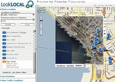
Let's see why it is impressive:
1. Google, Yahoo and Virtual Earth in the same application.
In a higher link you can choose what you want to see, and it's the first development I've seen in that you can choose Google maps, Yahoo maps or Virtual Earth in a single click.
2. Dynamic detail window.
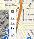 On the left panel there is a button that displays a window, with this you can have 1x, 2x, 4x approach and to surprise us more, change the map to satellite image or hybrid ... and as it is developed in Ajax, drag freely on the map without that requires reloading coverage.
3. Information Layer Side Panels
 In the left bar there are different options for displaying layers of information, such as hotels, restaurants and something that I found interesting ... traffic data. So you can activate the alerts and traffic cameras and see the live captures of those cameras!
4. Contextual ads on maps

And in order to finish, we have implemented Lat49 On the data so sites that are paying for advertising can show their ads according to the coverage they have paid; So they are displayed in another color and with a link that displays business data.
Additionally, it offers in the "extras" link plugins to add kml files, addons in Firefox and in Outlook ... yes, in Outlook!
So if they ask you Which application is better Between Google maps, Yahoo maps and Virtual Earth, you can safely say that Looklocal Well there you can see the previous three ... and more!


