
Implementation of technologies in Cadastre
Access the Geofumadas virtual disk to download the PDF file [paiddownloads id=”34″]
Systematization-Trinidad
Access the Geofumadas virtual disk to download the PDF file [paiddownloads id=”34″]
automated PDF extract
Systematization of good practices
Implementación
in the Municipal
The experience of Trinidad, Santa Barbara
A7
Systematization of good practices
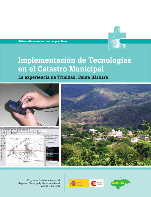
Implementation of Technology in the Municipal Cadastre
The experience of Trinidad, Santa Barbara
© Copyright 2010
Program Strengthening Municipal Regime and Local Development in Honduras
Col. Palmira, Calle República Colombia, No. 2315
5242 Post Office, Tegucigalpa, Honduras. Tel (504) 2232-2344, 2232-2247
E-mail. pfm@aecid.hn
Document prepared by: Víctor Rápalo and Golgi Álvarez
Address and Edition: M.Sc. Alma Maribel Suazo Madrid
PFM Coordinator, AECID-AMHON. First Edition: December 2010
Digital playback: 500 CD
Partial or total reproduction is authorized for purposes of study, disclosure, application or replication, provided the source is cited.
Contents
About Us | 5
About this document | 7
Part I
The cadastral experience
of the municipality of Trinidad | 9
The context of the municipality of Trinidad | 11
Limitations on the use of technologies for the municipality | 15
Aspects to consider in adopting technologies | 17
The cadastral experience
in the municipality of Trinidad | 21
The evolutionary process | 21
Results obtained | 27
Factors that influenced positively | 30
Lessons Learned | 33
Part II
Important aspects
for the sustainability of the cadastre | 35
The Sustainability of the Cadastre | 37
Sustainability at the local level | 37
Sustainability at the national level | 39
Implications of sustainability in the international environment | 42
Actions to boost
sustainability of the cadastre | 46
Technology choice options | 49
Technologies applied to cadastre | 49
Available software alternatives | 51
Is alternative free software? | 54
Examples of Technology Combinations | 55
Glossary | 57
Acronyms | 61
Home
The Program for Strengthening Municipal Regime and Local Development in Honduras (PFM), sponsored by the Spanish Agency for International Cooperation for Development (AECID) and under the institutional coverage of the Association of Municipalities of Honduras (AMHON), 2006 a process of strengthening local capacities in 28 municipalities and five municipalities of municipalities in Honduras.
One of its mandates is to generate a knowledge management system based on the systematization of the instruments and learning that emerged from the practice developed by municipalities and mancomunidades, rescuing the good experiences developed in the areas of administration, local development management and the strengthening of community organizations.
The process began with the training in the systematization of 25 technicians of the technical units of the CRA (Trinidad, San Luis, Concepción Norte, San Marcos, Petoa and Chinda) technical units, MAVAQUI (New Border, Protection, Macuelizo and Azacualpa), COLOSUCA San Manuel Colohete, Belén, San Sebastián, San Marcos Caiquín), MAMUCA (Esparta, Arizona, San Francisco, El Porvenir and La Masica) and MANCORSARIC (Copán Ruinas, Santa Rita, San Jerónimo), as well as the municipalities of Comayagua, La Esperanza-Intibucá and Santa Rosa de Copán.
The present product arises in the framework of the learning of the implementation of technologies in the municipal cadastre; in its first part systematizes the experience of the municipality of Trinidad, where several institutions have gradually contributed to the technical implementation and use of technologies to facilitate cadastral administration. The capacities of appropriation and continuity in this municipality are important factors of which are rescued valuable conclusions that can be useful to other municipalities of the country.
In its second part, the document considers the national scenario where the application of practices, laws and involvement of institutions related to territorial management can contribute to the technical and therefore technological sustainability. Finally, some basic aspects that must be considered when acquiring technologies to be used in cadastre are presented.
For the PFM this document constitutes a tool that seeks to promote successful practices in the municipal area. This and other products generated from the systematization of the program represent processes that must be maintained to create, replicate and contribute in this way to knowledge management and the promotion of local development.
Alma Maribel Suazo
Coordinator Program Strengthening Municipal Regime and Local Development, AECID-AMHON
6 Program Strengthening of the Municipal Regime, AECID-AMHON
About this document
The use of technologies in municipal administrative processes is no longer a new issue, especially in the use of computerized equipment and software. From the general application for the production of reports or records, to specialized systems for the orderly management of tax and financial information are indicators of modernization that seek greater agility in the analysis of information and better provision of services to taxpayers.
In the case of cadastre, the use of field measurement equipment and systems for the management of territorial information have had a good level of acceptance, since they facilitate the capture of information, analysis, linkage to databases and also the generation of final products for both taxpayers and other municipal departments.
However, the process of adaptation to new technologies has not always been successful in municipalities. In many cases, process automation, which previously operated in a manual and sustainable manner, has generated conflicts and setbacks and has not been able to confront or prevent the risk associated with change.
The present document includes two sections, the first presents the systematization of the experience of the municipality of Trinidad, department of Santa Bárbara, through the reconstruction of the different stages that the municipality has developed in the cadastre area thanks to its participation in different local and national initiatives.
The second section analyzes the linkage of municipalities with central levels based on existing legislation in the country. In addition, it summarizes some trends that municipalities and government institutions should consider to ensure the integration of efforts in the field of information technologies
with territorial approach1.
1 For the preparation of this document, the following sources were consulted: AMHON (2008), Analysis of the evolution and current situation of the Mancomunidades of Honduras. • Municipalities Law (Decree 85 - 1991) • Land Management Law (Decree 180-2003) • Property Law (Decree 180-2003) • Jürg Kufmann and Daniel Steudler, Cadastre 2014: A vision for a future cadastre system, at www.fig.net/cadastre2014/translation/c2014-english.pdf
The Trinidad Experience
• The context
• The process
• The results
Sustainability in the cadastre
• The local context
• The national context
• The international context
Practical ways to adopt technologies
Despite the accelerated process of changes in the technological aspect, this instrument constitutes a further effort of the Program Strengthening the Municipal Regime and Local Development to propose elements that lead to the creation of policies, decision making and implementation of practices that promote the
sustainability in the cadastre, both locally and nationally.
8 Program Strengthening of the Municipal Regime, AECID-AMHON
Part I
The cadastral experience of the municipality of Trinidad
Implementation of technologies in the 9 municipal cadastre
Chapter 1
The context of the municipality of Trinidad
General context
This section includes some specific aspects of the municipality of Trinidad, which facilitate the comparative relationship and the context under which the systematization process was developed.
The municipality of Trinidad is located in the department of Santa Bárbara in the West of the Republic of Honduras, has a territorial extension of 213.24 square kilometers, its topography is mountainous, and its average height is 200 meters above sea level (msnm ).
In 2007 its approximate population amounted to 18,792 inhabitants, distributed in 27 villages and 101 hamlets. (Human Settlements Unit, Ministry of Interior and Justice).
In development aspects, the municipality of Trinidad is located in category B (with intermediate advance). It is a member of the Regional Environmental Council (CRA), together with the municipalities of:
▶ San Marcos, San Luis and Petoa (Category C)
▶ Chinda and Concepción del Norte (category D)
The origins of the Trinidadian monastery date back to the late eighteenth century, formed by Spanish vectors, most of them from Chiquimula, Guatemala, who baptized the place as "El Vallecito de la Trinidad".
E n 1792 according to ol ic it ud alasub the C h a nd g g ion, to become a Municipality and the 14 of May 1794, the layout of its streets is made. It receives the title of City 18 of March of 1926.
(Taken from: The history of the municipal archive)
1 table | Categorization of municipalities
from Honduras. General Directorate of Local Development. Ministry of the Interior and Justice-SGJ (now, Ministry of the Interior and Population).
Category Number of municipalities
Percentage
(%)
A (Advanced) 23 8
B (Intermediate advance) 32 11
C (Little advance) 107 36
D (Without advance) 136 45
Total 298
Geographic location
of the Municipality of Trinidad
Honduras, Central America
Department of Santa Barbara
Commonwealth CRA
Municipality of Trinidad (delimitation published by the INE)
Technical context
The Cadastre department of the municipality of Trinidad began its functions in
1978 with the support of the Autonomous Municipal Bank (BANMA) and the International Agency for Development (AID). Its priority was focused on the tax aspect, focused on the collection of property tax under semi-technical methods.
In Honduras, the National Cadastre promotes the Land Titling Project (PTT), based on the Demonstrative Cadastre of the 1970s, with a multipurpose approach (for many uses). This project has as a priority the rural areas and covers seven departments including Santa Bárbara. Subsequently, in the 90 years, the municipality of Trinidad is selected as a pilot experience in implementing the urban-rural cadastre.
Since the reforms of the Municipalities Law, at the beginning of the 1990s, institutions such as the Municipal Development Foundation (FUNDEMUN) are promoting the process of strengthening municipal capacities, including the cadastre issue, taking up again the procedures established by the National Cadastre. Subsequently, various programs and projects are carried out in the Santa Bárbara area, including the PFM, which seeks to consolidate previous efforts by strengthening the capacities and systematization of experiences of the CRA Commonwealth so that its successful experiences can be replicated in other municipalities. .
Technological context
The last thirty years have been characterized by an increasing development of the technologies applied to the cadastral processes; The influence of the computer age and communications have brought development of programs and equipment that facilitate the handling of information. This type of tool is usually called technology, although this term is broader.
Technologies: The use of technology is old as man himself; Ancient civilizations are successful examples in their use for the construction of great works. In general, it is the application of science in the construction of instruments that facilitate man's performance of tasks with greater efficiency.
For this reason, technology is relative to the time when man uses it, but always depends on his inventiveness.
Information technologies: this concept evolves from the seventies with scientific application; and it becomes more common from the eighties, when the computer is economically accessible. In the local environment, since the 1990s, it has been integrated into municipal management, replacing manual processes for better information management.
Geomatics technologies: with this name are known the programs applied to earth sciences among which are geography, geodesy, cartography and topography, among others.
The geomatics was born as such in 1986 and its evolution from the nineties maintained an accelerated pace, like other computer programs. The application of geomatics technologies in the cadastral area has changed the way information is handled. Here are some examples:
▶ Computer-aided design (CAD) has been applied to the construction of maps, facilitating their modification and replacing manually drawn maps.
▶ The information of the cadastral parcels can be associated with the relationship with the people who own them and their solvency status in the payment of taxes, facilitating the construction of a map of taxpayers who have not paid their taxes. This is done using programs designed to manage geographic information systems (GIS).
▶ The measurement that was previously made with a tape measure and compass can be obtained with devices known as global positioning systems (GPS), with more accurate results and in less time.
▶ Aerial photographs are introduced to the computer, now known as raster images, allowing comparisons between different years and facilitating field surveys.
▶ Satellite imagery contains more information for analysis of deforested areas through specialized remote sensing programs.
▶ Cadastral data are published over the Internet allowing access to services efficiently and exchange between different dependencies.
These examples reflect the progress made by the technology applied to cadastre, advances that, as can be seen in the experience of the municipality of Trinidad, have made complex their implementation since it involves the purchase of equipment, programs, training and technical support. The following table reflects the difference in the use of geomatic technologies to replace cadastral processes.
2 Table | Evolution of the use of technologies in the municipal cadastre
Activity What was used 25 years ago What is used today
Field measurement
Tape measure, compass, aerial photography, theodolite, stereoscope.
GPS, total station, digital image. Tape measure for support
Mapping Drawing table, rules, squads, elaborated to different scales.
CAD programs interact directly with field teams, on a real scale
Publication
of results
Updating data
Hand-drawn maps for publication were printed
Modifications on final maps manually
Maps printed or distributed in digital formats
Users on the network, through controlled permissions
Collaboration Copies of maps Networking and Internet publishing
The limitations of use
of technologies for the municipality
Adopting a technology in the municipal context, especially with the specialized scope of the cadastral area, requires decisions that balance economic constraints, technical implications and sustainability in the medium and long term. Following are some reflections drawn from the experience of Trinidad, which can be applied to different municipalities.
Economic constraints
In developing countries and especially in local government institutions such as municipalities, the technical justification for the acquisition of a new technology is not sufficient due to the economic situation of the municipalities where the demands of the population are more high that the resources to meet them.
For a head of cadastre it can be easy to justify how the adoption of a technology will improve productivity in the exercise of their tasks. But it is difficult to assure that it will produce better economic results, and even more difficult to justify how the use of this technology will have an impact on improving the quality of life of the inhabitants.
To the extent that a municipality has limited incomes to meet the demands of the population, the priority in adopting technologies that do not mean a return on investment goes to
Painted maps do not justify an investment if they are not used as planning tools.
a secondary level. Thus, these actions require the support of external programs that recognize their priority, although this support generates some dependence, if not delaying the little progress in decentralization.
In the case of Honduras, municipalities have been categorized into levels A, B, C and D, with A and B having the most developed economic poles and at the same time providing the population with better access to basic services (at least in urban centers); the municipalities of categories C and D are of less financial efficiency and limited conditions favorable to the population for an economic deployment. Here is the 71% of the 298 municipalities. The municipality of Trinidad is in category C.
Limitantes by the fast evolution computer science
The accelerated pace in the computer evolution is an obstacle to its adoption; the investment in new equipment; the conversion of data to new formats and the need for training in the short term means a cost that is difficult to sustain. The illegal use of licenses (piracy) is one of the results of this high cost of keeping up to date, to the extent that it is a common practice at the level of individuals and, to a lesser degree, at the level of companies or government institutions.
As an example, a measurement equipment of the seventies, although with better precision than modern equipment, is almost impossible to use now because it does not adapt to existing programs that guarantee better productivity. Similarly, a computer five years ago has little use in a department that has updated the programs to recent versions; especially in the area of cadastre where the type of processes demand greater capacity in equipment and programs.
Institutional constraints
Many Latin American countries, whose democracies are recent or have gone through governance crises, face problems related to their central and local institutional strength, which
Procedures that do not work in paper formats, hardly work with computer applications.
they hinder processes and the stability of the technical resource, negatively affecting the use of technologies (corruption vices, unilateral decisions, staff turnover due to government changes).
Also the institutional weakness is reflected in the little effort to document, systematize, administrative procedures, which are those that have come to be realized by means of technologies.
Limitations in human resource training
Rotation of personnel by political clientelism and the difficulty of retaining qualified human resources emigrating to private enterprise has a high cost in the constant training of new personnel; depending on the tools chosen, will affect its sustainability. The programs and equipment of well-known brands have the advantage that it is easy to find human resources trained for their operation; however, the costs are higher. While the little-known and cheaper tools play almost the same role, the learning curve is longer, more expensive, and therefore difficult to sustain.
The formation of human resources is one of the reasons why high-cost programs, but of mass dissemination, are easier to sustain in the long term, while the turnover of personnel and the little habit of systematizing are not overcome by the institutions.
Things to consider
in the adoption of technologies
When adopting a technology in a municipality, be it a program, equipment or specialized contracting, it is necessary to take into account some aspects and the experience and specialty that local technicians and officials have about them. Some of these aspects are summarized below.
The municipal gear
The different departments of the municipality are dependencies that together make the municipal apparatus work. In the small municipalities, the cadastre staff fulfills multiple functions, but as these grow they are attended by specialized departments, maintaining a link with the management carried out by the cadastre. These include offices such as:
▶ Urban Planning and Control
▶ Environmental Unit
▶ Public Services
▶ Tax Control
▶ Community Development
The municipal corporation, for its different roles, requires the input of these departments; Ideally, the technologies acquired should be in tune with the scope that already has or can be had; preferably, that they can provide a service not only to a department.
Immediate applicability
If a technical procedure is being functional in the face of existing demand without the use of new technologies, these may not
are needed. This aspect is important to consider so that the adoption of new tools is made to the extent that it will have an immediate usefulness and an impact on the
The cadastre department is not an individual entity in the municipality.
optimization of time or provision of better services.
The following table shows the different solutions that may be required depending on the demand in the municipality.
3 table | Demand for technology in the municipal cadastre area
Activity Use in municipalities with lower demand
Measurement in urban areas Digital image, tape, compass, GPS
Measurement in rural areas GPS of minor precisions, digital image
Mapping Program to scan
(CAD)
Program to analyze results (GIS)
Optional, as demanded by the municipality
Total Station, GPS
of high precisions
Program to publish on the Internet
Results publication Printer Flatbed printer
(plotter)
Collaboration Networking with tax programs, printed maps
Publication on the Internet
The costs
It is difficult to ensure the immediate return of the investment made in the purchase of technologies. The decision should be made based on the adequacy of data or integration with other existing tools, training costs, technical support and possible growth in the medium term, not depending on the cost of the technology itself.
In practice, an economic tool can be a good decision if it can be found in good manuals, as long as this tool is adaptable in a scalable environment.
training
When acquiring a new program, the availability of training services should be considered, in the event that a human resource renounces or needs to be replaced. Funds should also be available for the development of manuals for procedures that facilitate induction, help to adapt new tools and extend sustainability.
The sustainability
Throughout this section there are aspects that refer to sustainability; This is summarized as the condition that a technology has when the service it provides compensates for the cost of a new update. Also because the human resource that uses it has formal conditions of continuity in their jobs or at least there are procedures, manuals and economic resources for training new personnel.
Example of sustainability:
A branded program such as AutoCAD is priced at US $ 4,000 while the price of BitCAD is close to US $ 30 0. BitCA D c onsu es with fu nc iona lities that a muni cipal unc a tta req uires, but its limited diffusion makes it an unworkable alternative.
Chapter 2
The experience of the cadastre in the municipality of Trinidad
The evolutionary process
The transition phases through which the cadastre occurred in the municipality of Trinidad follow a natural evolution, the result of conjunctural projects. Over a period of twenty-five years, it experienced continued and, to some extent, sustainable progress, given that many other municipalities had the same conditions with the lowest results. The stages of the process are exposed according to the priority approach of appropriation achieved by the Municipality.
Step 1. Basic cadastre with fiscal focus
This process was carried out before 1978 by empirical initiative of the municipality with an approach based on the collection of taxes. He tried to solve a primary problem consisting of the lack of taxpayer identification.
So he just sought to solve the question: Who would you
payment? The responsibility for the value to be collected remained in the good faith of the taxpayer through a sworn declaration of assets; however, it was interesting that
Tax management:
Who do I charge?
contributors on empirical maps that reflected their relative location. As a result of this stage began the management of the tribute.
One of the significant results was a topographic map of the potable water network in the urban center and hand-drawn schemes of rural taxpayers.
In the second phase of this stage, a semi-technified process was carried out in the urban area, always with a fiscal approach but with basic geometry and identification of the cadastral key. This process was initiated in 1978 with the support of the Bank
Autonomous Municipal Government (BANMA) and US cooperation funds (USAID). It was based on surveying the drinking water network and using only tape measure. Although the yards were measured, drawing was not considered its accuracy because only the width of streets and avenues. As a result the first urban maps were obtained with a zoning nomenclature based on quadrants around two perpendicular axes.
Map of Trinidad, empirical drawing
Step 2. Centralized cadastre with a multi-purpose approach
This stage began in the year 1990 with the separation of the Departments of Cadastre and Tax Control, although it became effective four years later, with the Land Titling Project (PTT), managed by the Institute
National Agrarian (INA) and executed by the National Cadastre, under a multifinal approach; although its immediate priority was fiscal and legal, entering into appraisal management.
This process was carried out by the National Cadastre, which in rural areas used the method of photointerpretation on aerial photographs with pocket stereoscopes and later emptying in orthophotomaps; although the municipality accompanied the process by means of interviewers, most of the technical work of delineation and valuation was executed by the personnel of National Cadastre.
Management of the appraisal:
How much do I charge you?
The survey included the total area
rural areas, not including human settlements
Map of Trinidad hand drawn
of villages, also the urban uprising of the municipal head was carried out; as part of the terrestrial control were located two geodesic control points integrated to the national network. In order to support the legal approach, maps of administrative boundaries were drawn up, including the delimitation of the municipal term and the definition of the legal nature of the land.
To support the fiscal and economic approach, studies of values, catalogs of typical buildings, classification of rural land and permanent crops were carried out. The result of applying these procedures answered the question, how much do I charge you? This process required high technology, but most of the technologies used were National Cadastre. It provided basic equipment to the municipality, but its use was limited to the maintenance of copies of maps and lists of taxpayers.
One of the best results of this stage was the systematization of procedures by means of technical manuals with official validity of the National Cadastre, which were applied in several departments of the country.
An important objective proposed by the National Cadastre was the integration of the cadastral inventory with national planning, with a methodology that included the necessary information with legal, fiscal, land use and economic approaches; although the centralization of processes and few conditions for a municipal appropriation made the continuity and updating of information complex.
Step 3. Cadastre with a technical modernization focus
This process sought to consolidate the phase previously implemented with emphasis on the use of local human resources, organization of administrative procedures and exploitation of the existing information potential.
Support at this stage was promoted by the Foundation for Municipal Development
(FUNDEMUN) with financing from the Government of
United States (USAID). It was important at this stage to integrate the different departments of the municipality and separation of functions; with this was answered the question how I charge and the boost of administrative management.
Administrative management:
How do I charge you?
At this stage, the same technical procedures implemented by Catastro Nacional were strengthened, and technical sustainability was prolonged, even though the central institution entered a crisis after it changed its dependence on the Secretariat of Planning to the Ministry of the Interior and Justice.
The municipal faculties reflected in the recent reforms to the Municipalities Law were also strengthened, as
Map of Trinidad digitized
the coordination of cadastral values, giving greater appropriation to the fiscal approach and promoting citizen participation.
As for the legal approach, procedures were applied for the definition of urban perimeters and the sale of full domains with the titling of lands in the ejidos.
As for the land use approach, the process of urban zoning and use plans was initiated. As a result of this stage, better local control of the procedures implemented and covered by the Law was achieved, which also meant important economic results. At this stage, teams were acquired to better manage information, such as compasses, GPS navigators, computers and integrated computer programs to different departments of the municipal administration.
As a specialized tool, FUNDEMUN developed and implemented the Integrated Municipal Information System (SIIM), which had different modules, including a cadastre for the management of the cadastral record; ArcView was used for mapping.
Step 4. Cadastre with a focus on technical sustainability
This stage aims to finalize the survey in the villages and update the existing survey. It obeys to a municipal management result of the continuity of the trained human resource, using own funds and formulating projects with organisms of cooperation between the years 1998 and 2004; hence the value of the process.
This stage responds to the first
two questions, but with a higher level of responsibility: Who else and how much do I charge?
In this period the acquisition of new technologies does not stand out, but it is important the non-stagnation and stability of the technical resource that reflects a positive concern to reach the total coverage of its municipality; an aspect that can be identified with territorial management. There are several rural settlements in villages where it has not been done before and some urban and rural areas are updated.
Territorial management:
Who else and how much do I charge?
Map of Trinidad with Manifold GIS
and orthophoto background
A large number of municipalities that received similar assistance in cadastre and municipal finance regressed or stagnated in this period.
At the end of the nineties, the passage of Hurricane Mitch severely affected the entire national territory. The cooperation projects changed their orientation and focused on the municipalities most affected and prioritized those in categories C and D, using the vulnerability approach. In these conditions it is valuable to rescue the effort of the municipality of Trinidad that continued with the established technical process and advanced on its own in the completion of the lifting or updating.
Step 5. Cadastre with a focus on technological sustainability
This stage is identified as of year 2006, and has the
Geomatic management:
How do I modernize it?
support of the Municipal Strengthening Program (PFM), with funding from the Spanish Cooperation and
institution of AMHON. It is developed on the platform previously created by the technical sustainability and only seeks to improve the conditions of technological self-sustainability.
The municipal cadastre had trained human resources, but had limitations to update the rural uprising, which was in printed maps. The mapping programs were illegal copies and the teams
did not have sufficient levels of precision and perhaps the immediate question was, how do I modernize it?
Map of Trinidad with Manifold GIS
and orthophoto background
Cadastral surveys are carried out using local human resources and with the management of the community. It is equipped with measuring equipment with better precision. In this way, the pending survey is completed, updating processes are carried out and the existing rural survey in printed maps is digitized.
This stage includes the modernization of computers and printers by more effective equipment, is provided with computer programs with better capabilities and under legitimate licensing, ie geomatics management.
For the choice of technological tools in the cadastre, those that could be sustainable and scalable were considered. For vector mapping, Microstation Geographics was chosen as the tool used in National Cadastre and that it had a corporate license for the use of municipalities as associated cadastre centers.
With this tool, the scanned maps are georeferenced, digitized and integrated with all available information, including satellite photography available in Google Earth.
For tabular data management, the municipality migrates from the system implemented by FUNDEMUN with data in Visual Fox to a platform with MySQL data and a more updated programming language known as the Municipal Financial Management System (SIMAFI).
For the integration of tabular data with maps, Manifold GIS chooses for its low cost and scalable potential equivalent to the commercial line ESRI, and on this a connection with the SIMAFI system was developed.
One of the priorities of the PFM is focused on strengthening the commonwealth, as a driving force for continuity in the administrative, financial and territorial management areas. Part of this process includes the visibility of results, through the systematization, preparation of manuals and replication of processes in other territories using the local human resource. Process that at the moment of elaborating the present document is executed in the western and central zones of Honduras.
Stage 6. Challenges to follow: Cadastre with contextual approach
This is a stage that the cadastre must address at the moment
that is ready; It implies high technology and integration in the context inside and outside the municipality. It must be implemented when conditions permit and its adoption is sustainable. Among the aspects to consider are:
Contextual management:
How do I integrate it?
▶ Update of the rural survey information. For this the municipality
you can expect coverage from the Land Management Program (PATH), which will provide you with new orthophoto and accurate survey of the entire municipality; meanwhile, an investment on existing data is not a priority.
▶ Greater use of existing information. The cadastre has valuable information that is not being integrated into the development plans of the municipality. Tax and legal use is, until now, the main application of the cadastre. There is a need to make better use of information, for example, on the subject of land use and socioeconomic aspects. On this aspect, the participation of governmental institutions in territorial planning and planning issues must meet the conditions for municipalities and associations to become involved with a more proactive role with mutual benefits.
▶ The publication of results online. Taxpayers and other interested institutions can consult the information that the municipality has. At the level of
publication, it is possible in the short term. But at the level of exchange, it depends on national institutions that have the responsibility to formalize publication rules for spatial data with which information can be exchanged; meanwhile, it is not a priority for the municipality.
Results
Summary of the process developed
Tax management
Who do I charge?
Management of appraisal
How much do I charge you?
Administrative management
How do I charge you?
Territorial management
Who else and how much do I charge?
Geomatic management
How do I modernize it?
Contextual management
How does
I integrate it?
Despite the pending challenges, the evolution of this administrative, technical, technological and institutional process has generated significant results that place the municipality of Trinidad in an enviable position in relation to others in its environment.
Comparative results at the Municipality level
Economic results The municipality has had revenue growth as a result of the implementation of the cadastre.
The graph reflects the annual growth in real estate collection (tax approach), from 82,000 lempiras in 1980 to 626,000 lempiras in 2007; noting an important growth in the interventions of the last seven years.
Other indirect economic results, not reflected in this graph, are the sale of full domains (legal approach), building permits (land use) and the provision of cadastral services.
1 chart | Income from the implementation of the cadastre in the period
1980-2007
700.000.00
600.000.00
500.000.00
400.000.00
300.000.00
200.000.00
100.000.00
0
1980 1990 1995 2000 2005 2007
Graphic and aesthetic results. Also the aesthetics of the cartographic products has had a technical evolution as shown in the following graphs, from empirical maps to digital maps.
Results in technical sustainability. The stability of the trained human resource reflects a degree of maturity reached by the municipality; It can be observed that the change of capacities was given with sufficient time, without interference from the changes of government that took place every four years.
❸ ❸
❷
Trajectory of the continuity and relief of the personnel in the cadastre area
1982-1999 1994-2008 2000-2009
Álvaro A. Orellana
1982 – 1990 Feet
Customer Service Representative
1990 – 1999 Feet
Head of Cadastre
Daniel E. Rápalo
1994 – 1998 Feet
Cadastre Assistant
1998 – 1999 Feet
Field support
Fiscal Auditor
2000 – 2008 Feet
Head of Cadastre
Víctor Manuel Rapalo
2000 – 2003 Feet
Eyeliner
2003 – 2008 Feet
Head of Cadastre
2008-2011
% Rural Municipality
% urban, including villages
Trinidad 100% 100% Chinda 0% 90% Petoa 0% 70% Conception North 0% 80% San Marcos 0% 80% San Luis 0% 60%
Comparison of cadastral survey in the municipalities of the CRA mancomunidad.
The map is based on the delimitation of the INE, does not coincide with the delimitation of National Cadastre.
Comparative results in the Commonwealth
Although in the six municipalities of the CRA community there were surveys in the same period as in the municipality of Trinidad, none of them has the map and its respective file in digital format, this reflects the municipal initiative to preserve and update this information.
In the case of the urban cadastral survey, all municipalities of the Commonwealth have a recent survey, but only the municipality of Trinidad has the
100% of their villages registered.
Comparative achievements at the national level
Like other municipalities in seven departments of the country, Trinidad is one of the municipalities that benefited from the cadastral survey project (PTT).
However, Trinidad is one of the few covered by the PTT that has the
100% of urban and rural surveying in digital format, including the valuation of
land, improvements and permanent crops.
The area of influence of the PATH implementation plan, during its first two phases, did not
inclusion of the department of Santa
Map of different interventions in the urban and rural cadastral survey of the municipality
Barbara; However, due to its potential and advances, this municipality could be considered a pilot of integration between the National Cadastre and the Municipal Cadastre. Due to the results achieved, the systematization of this experience constitutes an important achievement for the municipality of Trinidad, which will have the opportunity to value its results, and to replicate the experience in other municipalities.
Factors that influenced positively
The significant achievements of the municipality of Trinidad are not due to a single factor but to a succession of processes and conjunctures that the municipality has managed to empower.
to. Institutional factors at the central level
The modernization of the National Cadastre: since the 1970s, the National Cadastre with international support implemented technified processes and executed projects of national scope. Among these is the Land Titling Project (PTT), which had a significant impact on the rural uprising of the Municipality of Trinidad, and later the urban uprising of the municipal seat.
Map of the area of influence of the 1 and 2 phases of the Land Administration Program of Honduras (PATH), whose emphasis is on the modernization of Property Registers and updating of the cadastral survey under a legal regularization approach, prioritized by regions of greater transactional volume. As of the date of preparation of this document, these phases project coverage in close to 90 municipalities in 7 departments and 9 registry districts.
▶ With 24 municipalities benefited, Comayagua and Islas de la Bahía are the departments with coverage developed at the level of property regularization.
▶ The department of Cortés and the Municipality of the Central District in Francisco Morazán (13 municipalities in total) are in the process of modernizing property registers and systematic regularization.
▶ Atlántida, Francisco Morazán, Colón and part of Gracias a Dios (around 40 municipalities)
they are preparatory processes with selective coverage.
▶ In preparatory activities the department of Choluteca is projected (16 municipalities included).
The Law of Municipalities: the new Law, at the beginning of the nineties, mandates grant autonomy powers to the municipality so that it can manage its territory and apply policies under a legal framework in aspects of collection, land management, land titling, etc. .
Modernization of the property registry: this process, executed by the PATH with the support of the World Bank, is projected for twelve years; although the Trinidad area is not in the short term planning, its existence allows the municipality to take complementary steps to the results that will be obtained once the regularization process has begun. The priority of the project executed by the PATH is a legal approach, but municipalities can develop complementary processes so that the usefulness of the information is applicable to other approaches, such as fiscal or socioeconomic.
Institutional factors at the local level
Technical sustainability of the Cadastre department. Many results achieved in the municipality of Trinidad are due to central level projects, but the continuity and appropriation of technical processes by the municipality were determining factors, mainly in the political will to follow up the results and management with aid workers for the strengthening local.
The Commonwealth CRA. The fact of having a common set of municipalities with an Intermunicipal Technical Unit has facilitated that the last projects to strengthen the cadastre have been executed with a significant role by the Commonwealth in the management, monitoring and systematization.
Short-term factors
International Cooperation. At all stages of the development of the Trinidad municipality's cadastre, there is a strong role of international cooperation; initially USAID through National Cadastre, INA, BANMA and FUNDEMUN; later the Spanish Cooperation and in projection the World Bank.
FUNDEMUN. The Foundation for Municipal Development played an important role in the technical sustainability of the processes implemented by National Cadastre; also intervened in the modernization and strengthening of other technical, administrative and financial departments of the municipality of Trinidad under the impulse of the Law of Municipalities.
The contribution of the PFM
As of year 2006, the Municipal Strengthening Program (PFM), funded by the Spanish Agency for International Cooperation for Development (AECID), with its counterpart the Association of Municipalities of Honduras (AMHON), supports in different areas of the country in the areas of Financial Management, Land Management and Local Economic Development.
These areas include the CRA Commonwealth. And to avoid duplication of efforts in the Trinidad municipality's processes, the PFM prioritizes its intervention in order to promote sustainability within the area of influence. For this, processes are developed focused on:
▶ The retrieval of existing information and migration to more recent formats: equipments are needed, personnel are trained in the digitization and georeferencing of analog maps and integration into the financial database.
▶ The strengthening of local capacities through human resources training of the different municipalities and the Commonwealth. During these processes urban / rural surveys were carried out and, in the case of Trinidad, cadastral maintenance was promoted in areas requiring updating.
▶ Strengthening the capabilities of the Commonwealth for the appropriation and continuity of efforts made.
In order to promote sustainability, different actions aimed at the continuity of efforts were developed: local technicians were selected to develop replication exercises in other mancomunidades with training processes, cadastral surveys, urban perimeter studies and cadastral values agreement.
In the topic of systematization, manuals were developed or updated, and local experiences were documented to promote continuity and appropriation by other territories.
Lessons learned
▶ Much of the technical sustainability lies in the stability of the trained human resource. As long as the salaries are consistent with the economic productivity of the Cadastre Department and its capacity is respected during periods of government transition, there is an important guarantee of technical sustainability.
▶ Technological tools must streamline administrative procedures, which work even when technology does not exist. If a procedure is not functional
using paper and pencil, a computer program will hardly make it functional and, even if it is solved, you always have to be ready to do it manually.
▶ The technological sustainability of the cadastre is achieved after technical sustainability. If the human resource is not stable and the procedures are not documented, technological implementation is not possible (or necessary).
▶ The cadastral map will always be an imperfect model of reality, geomatics technologies facilitate its updating, but it is still imperfect. Investing resources in perfecting a map can be unproductive if there is no assurance that continuity and updating in the use of that information can be maintained to promote development.
▶ The political and administrative decisions of local governments are the best strategy for sustainability of the actions implemented by national institutions. Many techniques applied by National Cadastre would have been lost, if the municipalities had not continued their use and updating.
▶ Cooperation projects can promote sustainability in the cadastre area, if it is to consolidate existing results and double their scope under a local approach. But sustainability depends to a large extent on the responsibilities of local governments and their human resources, in an agile and responsible manner.
▶ The experience of the municipality of Trinidad found that the sustainability of the technologies lies in the technical sustainability of those who carry out the cadastral and administrative work of those who make decisions about their use and the systematic influence of the institutions responsible for dictating the standards.
Part II
Important aspects for the sustainability of the cadastre
Implementation of technologies in the 35 municipal cadastre
Chapter 3
The Sustainability of the Cadastre
The municipality of Trinidad is an example where its processes occurred in the creation of opportunities. Thanks to local appropriation, there are sustainability conditions in the results of 27 years. The municipalities do not
can wait so long, without guarantees, and
international cooperation will not always be to continue investing in results that are lost. It is therefore necessary, within the national scenario, to find grips on which technical, administrative and technological sustainability can be built for the cadastre.
Sustainability at the local level
Graph of the three levels of technological sustainability within the framework of the Territorial Organization.
There is no recipe for factors that can be universally applied, but in the light of the experience of the municipality of Trinidad are some principles of general use. Whether or not national conditions are met, municipalities should seek sustainability on the basis of their own capacities; if on these demands the national authorities intervene, the results will be better.
The stability of the trained human resource
The continuity of the trained personnel maximizes the sustainability of the technical processes, the durability of the computer equipment and reduces the loss of information; The municipality of Trinidad is an exemplary lesson. This is a challenge
in Honduras, because the law that protects the career of the municipal official has not yet been approved, and once approved it will take many years to see effective results. Meanwhile, the municipalities must promote with their own means, their own policies to solve the problem of staff turnover for reasons of political patronage
The reinvestment of funds from the cadastre
It is demonstrated that the implementation of the cadastre produces favorable economic results, the municipalities must dedicate a percentage of these funds for reinvestment in the cadastre, to continue the survey, maintenance, updating of equipment and to pay adequate salaries for the personnel that works in the Department.
In the municipality of Trinidad, trained human resources were found, with salaries not according to their results; This is a risk that should not be run, because the resource can be lost when it finds better opportunities.
The documentation of procedures
The existence of documented processes helps technical continuity and technological readjustment. The municipalities should promote the development of skills of the technicians in the systematization of experiences and updating of manuals, in case of acquiring new programs or equipment, it is easy to update them and adapt the procedures to the changes.
The planning
The practice of goal-based planning can yield better results not only in the cadastre department. The work on this topic never ends, between the daily activities and the cyclical ones as the
Values, valuation notification for real estate tax, cadastral maintenance and government transitions, it is possible to establish plans and teach technicians to measure their achievements based not only on activities but on impact.
The deconcentration of technical activities
Not all cadastre activities should be done by municipal officials. An alternative is gradually to deconcentrate activities towards the private sector. It does not apply to all environments, but it is possible through microenterprises or joint services to reduce costs in processes such as the coordination of values, updating of land studies, building catalogs, technical support and even massive uprising.
Sustainability at the national level
Honduras has several institutions, laws and systems that are favorable for the promotion of sustainability. Taking advantage of these instances from the central level can reinforce the local aspects mentioned above, and at the same time lead the development of the country towards integrated territorial management.
Building initiatives within this legal scenario is sustainable, because it is what remains and the hierarchy of coordination is framed within the following competent institutions:
Law Institutions involved Systems
- Law of
Municipalities
- Law of the
Intellectual
- Law of Territorial Organization
- 298 municipalities
- AMHON
- Associated centers of cadastre, including municipalities.
- Property Institute
Directorate of Land Management (SGJ) and the different committees created, which make up the secretariats, universities and institutions related to the territory such as:
- Interagency Commission of
Infrastructures Spatial Data (CIIDES)
- Interagency Land Commission (ILC)
- Departmental Councils of
Territorial Planning (CODOT)
- National System of Property Administration (SINAP)
- Unified System of Records
(SURE)
- National Information System
Territorial (SINIT)
- Register of Regulations of
Territorial Ordering (RENOT)
- Specialized subsystems of
SINAP
The Law of Municipalities
Within the framework of municipal autonomy, this law provides sufficient capacity to the municipality to manage its territory, always within the respect of national legislation; but the municipality is not alone, there are different levels of association that drive the initiatives of the municipalities and collaborate towards a better management, among them:
▶ Commonwealths. They play a valuable role in the execution of projects, management with cooperating agencies and continuity of efforts in governmental changes. Honduras has not yet exploited its potential in the provision of services and advocacy capacity among the local, regional and national environment.
▶ The Association of Municipalities of Honduras (AMHON). As a guild of municipalities, it has a great potential in interinstitutional coordination and political influence in the legislation, which contributes to the interests of municipal sustainability in subjects such as:
• Transition of local governments
• Decentralization policy
• Dissemination and exchange of experiences
The Law of Property
Here are presented instruments that facilitate the conditions for the integration of the municipal cadastre with the National Cadastre, which together with the Property Registry and the National Geographic Institute, became the Property Institute (IP).
The National System of Property Administration (SINAP). This system is contemplated in the Law of Territorial Organization, but part of the operative process of the Program of Administration of Land of Honduras (PATH), to the year 2016 will be implemented in the 18 departments. The objective of the SINAP is to be a reference system that concentrates the transactional processes of the country linked to ownership; It is made up of three main systems:
▶ SURE. Unified System of Records, which
integrates the different property registers, among them the Real Property Registry and the Cadastral Registry.
▶ RENOT, R egistro de N ormat iv of Territorial Organization, extracts geographic data from SINIT, which restrict the use, dominion or occupation of the land and sends them to SURE as affectations in the cadastre plots.
▶ SINIT, National Territorial Information System, which registers and publicizes the general cartography of the territory.
The associated centers of cadastre. That is the name that municipalities receive as partners of the National Cadastre. The cadastre regulation
defines the rules of collaboration through which they benefit, such as:
▶ Responsibility over data
▶ The rights and roles in interaction with SURE
▶ Program licensing
▶ The official validity manuals
▶ The precisions and methods that should be applied
▶ Periodic training of the municipal resource
▶ Coordination with projects that run the cadastre in the municipalities
The law of territorial order
Here there are conditions for the municipality and the different institutions of the country to promote sustainable development under an integrated territorial approach. For this, the Law creates different instances with which the management can be interconnected, among them the subsystems of SINAP, which are under the responsibility of the General Directorate of Territorial Planning and the Ministry of the Interior and Justice.
For example:
▶ In SINIT, the municipality as an active partner can update the system within its competencies, and have access to the different layers of information that other institutions share through this system.
▶ In RENOT, the municipality has the power to register its regulations, such as urban perimeters, zoning, areas of road projection, micro basins that supply their communities, etc. so that these are reflected in the plots of the cadastre as restrictions. At the same time, it can know those areas of its territory that have special restrictions or attributions by other institutions, such as forest management plans, mining concessions, protected areas, etc.
The Law also integrates the municipalities into different commissions and councils that intervene in local, regional and national decisions with AMHON representation. Among these commissions stands out for its impact on technological sustainability:
The Interagency Commission on Spatial Data Infrastructures (CIIDES). In this, the AMHON represents the municipalities and with other institutions define the minimum standards and attributes of the infrastructures of spatial data at national level (INDE). Also within the framework of this commission can promote policies such as the use of free licensing tools, comply with established standards for spatial data management and that can facilitate sustainability by commercial software costs.
With the creation of the Secretariat of Planning, several of these instruments acquire better conditions of implementation and local ownership.
Implications of sustainability in the international environment
The previous sections reflect aspects of the local and national environment that under an aggressive strategy can be addressed in favor of the technical and technological sustainability of the cadastre in Honduras. This section considers the international context, in which there are no generally accepted norms, but there is at least one document of significant importance that is being considered by the countries as a benchmark for the trends for which the cadastres should be prepared.
This document is "2014 Cadastral Model", which appears in 1994 under the initiative of the International Federation of Geometers (FIG), which proposed to twenty years as the cadastre in 2014 year based on technical, technological and economic trends of the world. At 15 years of its publication it is opportune to make a brief analysis of the six declarations raised there.
1 Statement. The Cadastre reflects public and private law
The best example is the Register of Land Use Regulations (RENOT), which makes the public order restrictions reflected in the cadastre. Thus, the buyer of a property acquires a property, knowing that it has effects such as:
▶ Under a high voltage line that restricts you to build buildings, you can have crops but you can not fumigate using a small plane.
▶ In a declared area of flood risk, where the municipality does not issue construction permits.
▶ In the buffer zone of a
protected area, where it can not do any construction, but it can receive economic compensation because it combats global warming.
The 2014 cadastre will indicate the complete legal status of the territory, including public law and restrictions.
This declaration establishes that public law must be reflected in the cadastre, maintaining the principle of legal independence, as corresponds to the institution that sets the standard. The municipalities, with or without the RENOT, must include public rights in their cadastral base, such as street easements, urban perimeters, use plans, river protection belts, maps of a legal nature, and all those that they consider must reflect the restrictions or attributions of the buildings. The implementation of SINAP will facilitate this process.
2 statement. The non-separation between maps and records
This statement is framed in what the
geographic information systems (GIS), in which the color, line type, area, geometry and other attributes of a plot are contained in a database.
No separation between maps and records.
The implication of this tendency is that the training in geomatics issues should be included in the requirements of the municipal cadastre technicians and in the training plans of the institutions dedicated to municipal strengthening.
3 statement. The replacement of cartography by modeling
This is one of the most complex changes to be adapted by traditional technicians, given that modeling is a term coined by the adoption of technologies. The traditional way of doing cadastre carried a linear process of obtaining data in the field, emptied into manually and artistically elaborated maps; the data recorded on card index cards were, at most, digitized for the purpose of printing copies and generating reports.
As a result, the update in the paper took precedence over the digital one.
Thinking about models requires a change in the process. In the data models, the cards and maps are only instruments to capture or publish the information. They are not an end in themselves, because they are inputs to generate new analyzes, new maps, and updating has digital information as a priority.
Modeling involves the construction and updating of information under a controlled environment, with different databases called repositories, where users have roles and rights managed and most analyzes are scheduled for the systems to do. The Internet environment has given it a greater degree of complexity, since maps are not provided, but "data services" are exchanged under publishing standards that can be read by different brands of programs.
This may seem complicated for practical purposes of a municipality, but at a computer level the programs are capable of doing so; the challenge falls on the resource
Conventional cadastre process
Delination
Creation of final maps
Maintaining maps
Digitization maintenance
sheet
Scalable cadastral model
human that must implement them and keep them updated at the pace of technological evolution. For many municipalities with limitations the conventional process is appropriate, as long as it produces good
Conventional cartography is a thing of the past, the modeling of the present.
results. But the central institutions must work hard to find sustainability strategies since the trend is irreversible.
4 statement. The manual cadastre replaced by the spatial model
This statement is similar to the previous one, although it does not only focus on technology, but on the roles of those involved. Many cadastre methods were established by the existing conditions and tools; the use of mapping programs facilitates obtaining data in the field, which can be delegated to a third party, not necessarily a municipal employee.
The final maps were previously true works of art for their level of elaboration, now the maps are imperfect models of reality, constantly updated, and in many cases, they are not even called maps, because when interacting on the computer, the name that he received that printed map in scale.
The manual cadastre will be a thing of the past
This trend is worrying because the custom "what matters the map, what is the topology" makes the wealth of standards written under the conventional processes is lost and despised the experts in cartography because they do not know how to use the ArcView.
Institutions with a regulatory role, such as the Property Institute (IP) and the Interagency Commission of Spatial Data Infrastructures (CIIDES), must work hard to build manuals, procedures and standards that adapt to spatial models, but that rescue the systematic rigor.
5 statement. The private and public sector work together
It is no longer necessary for the municipal employee to do all the work. For example, the measurement of a property to 60 kilometers from the municipality, where the taxpayer must pay the employee's per diem, the measurement, the map and there is no guarantee of efficiency, because this is not enough and the measurements only make them on special dates.
A local technician, under fees set by the municipality and accredited by the commonwealth, can sell that service and assign a percentage to the municipality
2014 Cadastre will be highly privatized
at the time of obtaining the stamp of the cadastre department. It is only an example of what already happens, but without clear tariffs, guarantee of quality of work and, many times, without the map reaching the cadastre department.
The challenge in this trend is that procedures must be built and there is a capacity to accredit these service providers. National Cadastre and the mancomunidades must work on this issue, because it can help solve the problem of information outdated.
6 Statement. Best value for money
To date, almost all of the cadastral surveys are carried out with international cooperation funds. Although a large part of the collection comes from cadastre, the municipalities do not allocate funds to carry out survey and periodic updating.
It is necessary to construct creative models in
that the cadastral survey is self-sustaining, integrating the benefits of the concession, the collection of real estate, the sale of
The Cadastre 2014 will proceed to the recovery of costs
services, economy of scale, national cadastre and other departments of the municipality, that is, not only have funds to continue the survey, but also to support the formation of human resources in transitions and computer equipment.
Actions to boost
the sustainability of the cadastre
The availability of laws and national instances allows that decisions can be made and concrete actions can be taken to promote the sustainability of territorial ordering, beyond the topic of cadastre. Below are some tasks that must be carried out, some are already being promoted, others represent great challenges; Together they contribute to the creation of conditions for the technical, administrative and technological sustainability of the cadastre.
In the context of the Law on Municipalities
AMHON should continue to promote initiatives that benefit the continuity of municipal processes such as:
▶ The civil career of the municipal official, which establishes the minimum competencies that must be had by the technicians employed in cadastre, their job stability, and limitations for mayors regarding the removal of personnel by political aspects.
▶ The creation of a municipal institute, which can coordinate efforts for the official availability of access to training and creation of instruments for municipal use, in coordination with related institutions such as the Superior Court of Accounts and the Ministry of Interior and Justice of the Interior and Population).
▶ Update of the Law of Municipalities in matters of territorial management, in defense of autonomy, but in harmony with other laws such as the Law of Property, Law of Land Management, Forestry Law, Civil Code, among others.
▶ Promotion of the decentralization of resources and competences from the central to the local level, including regional units, mancomunidades and municipalities, not only in the economic area, but also including the territory as part of integrated management.
In the context of the Law on Property
The National Cadastre must be strengthened in terms of facilities, equipment and personnel trained to promote the technical sustainability of the municipal cadastre. Also through the integration to the different commissions of the Law of Territorial Order, the cadastre can:
▶ Focus on the systematization and continuity of manuals, procedures and standards for the management of cadastral data, in keeping with international trends.
▶ Coordination with institutions and universities for the provision of training services on administrative, legal and technological issues applied to the cadastre.
▶ Promotion of a multi-purpose cadastre model, which can be adapted to different conditions of associated cadastre centers (including municipalities), with minimal characteristics for their integration into a national system.
▶ Modernization of existing normative capacities in the National Geographic Institute to regulate in cartographic, within the framework of CIIDES and without dual roles within SINIT.
▶ Involvement and accreditation of the private sector as a service provider in
subject of territorial management, in addition to the trade association at different levels of the geomatic environment.
In the context of the Territorial Ordinance Law
The SINAP must be constituted in the official system of publication of spatial data, taking advantage of the capacities of the subsystems SURE, SINIT and RENOT; and involving the municipalities as guarantors of its updating and application. For this purpose, initiatives can be promoted within a National Plan of Territorial Ordering such as:
▶ The creation of a national strategy for the integration of the different SINAP partners (including municipalities and AMHON), under cooperation agreements adapted to business models in which all win for the updating, administration, publication and sale of services.
▶ The use of open source licensing with national support as an alternative
to reduce costs and illegal use of commercial programs.
▶ The application of international standards in the publication protocols of the
SINAP to maintain full access to the municipalities, use these programs of commercial and open licenses. This reduces costs due to the transformation of data between different formats and is integrated into the international context.
▶ The continuity of commissions such as CIIDES for the definition of standards within
of an interinstitutional collaboration framework.
▶ Coordination with the official bodies responsible for updating data,
diminishing the duality of functions and taking advantage of the inter-institutional relationship. In this way you can have, for example, update periodic digital images, with shared use and sustainability.
▶ Promoting non-profit initiatives for the sustainability of systems and processes,
reducing the incidence of political clientelism, diminishing the capacity of projects and losses due to government transitions.
Chapter 4
Options for choosing technologies
The political and administrative conditions of the country do not ensure that many of the aforementioned approaches will be implemented in the short term. This section shows practical ways and principles that a municipality can take on, but not depend on, national efforts. As it is addressed to technicians who dominate the technological aspect of cadastre, many of the terms in this chapter are of the domain of specialized users; however, to facilitate its implementation, some of these terms have been mediated for users
not specialized; and others are explained in the glossary.
Technologies applied to cadastre
The cadastre process consists of at least five phases: from field survey to publication of results. Excluding non-computer technologies (compass, tape measure), specialized technologies for the cadastral area can be divided into equipment and programs.
4 Table | Technologies used in cadastral processes
Activities (Hardware) Software (Software)
1 GPS field survey, total station, distance meter, PDA, digital camera
2 Map scanning Digitizing table, scanner
For downloading data
(GPS and total station)
Example: Fugawi
For vector construction of maps (CAD)
Example: AutoCAD
Activities (Hardware) Software (Software)
3 Digitalization of cadastral records
For database management
Example: Access
4 Integration of maps and data
5 Publication of results Printer, plotter, Internet connection, network connection
6 Controlled maintenance Same lifting equipment
For Geographic Information Systems (GIS)
Example: ArcGIS
For publication of map services
Example: ArcGIS Server
For data management
Example: Project Wise
Depending on the demand of the municipality, other equipment may be required, but always to fulfill the same activities.
1. For the field survey, most teams bring their own software to connect to the computer or to mapping programs; These equipments serve both for massive data capture and for update on demand. Among these programs are: Fugawi, Mobile Mapper Office, Mapsource, etc.
2. To build the maps, CAD programs are usually used, which have enough tools for vector construction, such as AutoCAD and Microstation. Specialized programs for GIS have many tools to build data, but they are not always practical for mass construction (technicians prefer CAD programs). There are also programs for the transformation of scanned maps to digital formats in a semi-automatic way, such as AutoDesk Raster Design and Microstation Descartes, which are also replacing the use of digitizing tables. In the case of documents, digital records control programs have progressed as Dossier Manager.
3. For the digitalization of the cadastral records, there are usually programs adapted to the municipal environment, which facilitate the entry of information and execute the valuation calculations; additionally they have associated modules for departments such as Tax Control, Treasury, Accounting, Public Services, etc. Among these programs are: SAFT, SIMAFI, SIGMA, SIIM; all of them fulfill the function of managing information in a database that can be Access, SQL or MySQL.
4. To integrate the data of the card with the maps, specialized programs in GIS are used: ArcGIS, AutoCAD Map, Bentley Map, Manifold GIS, gvSIG, Qgis, among others. Some of them are CAD versions with mapping capabilities, which allows them to fulfill both functions; They generally have functionalities to integrate other layers of information, produce new products based on data analysis and specialized treatment of satellite images, known as remote sensing.
5. For the publication of results, the CAD and GIS programs have the capacity to generate maps or reports in a printer or plotter, they can also export maps or reports to image or pdf formats. There are extensions of the GIS programs that publish this function, such as ArcGIS Server, GeoWeb Publisher, MapGuide, Manifold GIS, MapServer, etc. If the data presented in this way respect the standards, this information can be accessed using different CAD / GIS programs in a local network or over the Internet.
6. To update data in a controlled manner, there are programs that manage the rights to users, so that changes are made from transactions, preventing a map from being edited by another user while in
Phases of the cadastral process
1. Survey in field
2. Digitization of maps
3. Digitization of chips
4. Integration maps and cards
5. Publication of results
6. Controlled maintenance
maintenance. These facilitate the creation of backups and store historical changes. Commercial programs have applications for these purposes, for example Bentley Project Wise, AutoDesk TopoBase, ESRI ArcSDE.
For small municipalities, implementing the 5 and 6 stages depends on the demand and connectivity conditions that the municipality may have.
Alternatives
software available
As explained in the previous section, there is a wide range of programs that can be used in the cadastre; Based on price, they can be grouped into:
▶ Commercial programs of recognized brands
▶ Low cost commercial programs
▶ Open source or open source programs.
For illustrative purposes the following comparative table can help to understand its advantages and disadvantages (approximate prices of the 2009 year).
5 table | Advantages and disadvantages of programs used in the management of territorial information
Commercial programs of recognized brand
- The brand is recognized, there are more technicians who know the program.
- It is easier to find or promote a training.
- There is little chance that the program will be discontinued.
- There are solutions for the different stages of cadastral management.
- It usually has an accelerated evolution and changes in the format.
- There is no complete freedom to make changes to customize the program.
- Prices tend to be high for the economic capacities of small municipalities.
Example:
- CAD Programs: US $ 4,000
- GIS programs without extensions: US $ 1,500
- CAD programs with GIS capabilities:
US$ 6,000
Low cost commercial programs
- They comply with almost all the functionalities that are needed of the brand software.
- There are less format changes between different versions.
- Prices are close
of the 20% less than what the programs cost
of recognized brand. Example:
- CAD Programs: US $ 400
- GIS programs without extensions: US $ 300
- CAD programs with GIS capabilities: there are not many options,
using the first two would be US $ 700
- They are not well known, therefore there are not many technicians that master them.
- It is not easy to find or promote a training.
Free use programs
(open source)
- Some of them have matured and achieved recognition. example: Grass, gvSIG, qGIS.
- You do not have to pay to use them, everything that is developed on them is free to use.
- The code is available to make adjustments to the need.
- There are several collaboration networks via internet where you can find support.
- The available tools are complemented between vector (vector) and image (raster) specialization
- The range is very wide, and many of them
could be discontinued or merged with other initiatives.
- Recognized brand programs have restricted access to the most recent formats.
- Sustainability in the long term is not guaranteed for all existing programs.
Commercial programs of recognized brand
- Due to its sustainability, they are a solution for projects or programs in the central government; but it is not viable for all municipalities to acquire them.
Low cost commercial programs
- They are a solution to the recognized brand software; although they are not recommended for country initiatives where you can invest in development on free software or brand.
Free use programs
(open source)
- They are a solution for the municipalities, if it is invested in training and documentation of the procedures.
6 table | Programs of extended use that can be used in the management of
territorial information
Commercial programs of recognized brand
For use GIS + CAD Autodesk Map 3D Microstation / Bentley Map
To use GIS ArcGIS Geomedia MapInfo CadCorp
For CAD use AutoCAD Microstation ArchiCAD DataCAD
To use Web AutoDesk MapGuide ArcGIS Server GeoWeb Publisher
For CAD use
Allplan Archiline Caddy CYCAS Form.Z
For use GIS CartaLinx Carlson GIS TatukGIS
SITAL TransCAD
GE Smallworld Caris Maptitude Mapsuite TNTMips
Low cost commercial programs
For CAD use BitCAD BricsCAD ProgeCAD CADian CADopia
4M IntelliCAD
To use GIS Manifold GIS Global Mapper IDRISI
For Web use
Manifold GIS ultimate
Free use programs
(open source)
To use GIS (Vector)
GvSIG
Qgis (Quantum GIS) JUMP
Kosmo
To use GIS (Raster) SEXTANTE
GRASS
For Web use
MapServer
MapGuide Open Source
GeoServer
For CAD use
QCad
FreeCAD
For GIS use
uDIG SAGA GIS
Generic Mapping Tools
LocalGIS ILWIS GeoPista
There are also free programs (such as Spring and SavGIS), but there is no guarantee of sustainability; other types of applications are limited versions of commercial programs like BentleyView, TrueView, ArcExplorer, with these generally only information can be visualized. With the rise of the Internet are emerging new alternatives of publication and visualization via the web, such as Google Earth, although their use for purposes of precision work is limited or their functionality impractical
Is alternative free software?
Commercial software is important because it gives the market sustainability and development trends. In recent years, free software has collaborated so that international trends meet standards. In the geospatial field, these have been regulated under the Open GIS Consortium (OGC) initiative. As a result, the diffusion of open source initiatives has progressed in the different needs of computing, to the extent that some Hispanic countries have implemented partial or total migration policies, reinvesting licensing costs in systematizing experience, processes and adapting developments.
In the case of cadastre, the combination of solutions offers better results than the software of mark, surpassing it in many aspects. The following combinations are those that present better perspectives of sustainability:
gvSIG + SEXTANTE. This is a Spanish initiative, both programs complement each other; the first with much CAD / GIS construction capability and the second in image processing (remote sensing). The biggest advantage of this alternative is the language and the systematic information of best practices published on the Internet.
Qgis + Grass. They complement similarly, they are Anglo-Saxon initiatives, with acceptance not only in the English medium. In many respects they have more maturity than the first alternative. The disadvantage of this combination is documentation; although manuals exist, official support is in English and many development documents are not translated into Spanish.
PostGreSQL + Mapserver. This combination is widely used for the publication of data on the Internet; the first as a database manager, and the second as a publication support. In addition, to expedite the speed of publication,
they use libraries of other initiatives like PostGIS, MapBender, Openlayers and tilecaché, some of payment.
In conclusion, free software is a viable solution in a municipality, as long as alternatives for updating and / or training of personnel and continuity of processes are considered. Basic actions such as developing procedures manuals, systematizing the experience and decisions to maintain consistency are achievable.
Examples of combination of technologies
free software is a viable solution in a municipality, as long as alternatives for updating and / or training of personnel and continuity of processes are considered. Basic actions such as developing procedures manuals, systematizing the experience and decisions to maintain consistency are achievable.
7 Table | Programs available for the management stages in the cadastre
Software
Construction
Stages of management in the Cadastre
Integration
Publication
Management
Business
CAD Database
GIS
websites
controlled
AutoDesk AutoCAD Map SQL Server AutoCAD Map
MapGuide Topobase
Bentley Bentley Cadastre Oracle Bentley
Register
GeoWeb
Publisher
Project Wise
ESRI AutoCAD SQL Server ArcGIS GIS Server ArcSDE
Low Cost Commercial Software
manifold
BricsCAD BricsCAD
Software
spirit
SQL Server
Express Manifold Manifold Manifold
gvSIG +
SEXTANTE gvSIG PostgerSQL
Qgis +
gvSIG + SEXTANTE
MapServer + Bender
MapServer +
PostgreSQL + PostGIS
PostgreSQL +
GRASS PostgreSQL Qgis + Grass
Bender
PostGIS
2 Chart | Ways to integrate the stages of the management combining tools of commercial and free use.
AutoCADLT / BentleyPowermap
(US $ 1,100) + ArcView (US $ 1,500) + ArcPad (US $ 500)
Total US $ 3,100
ArcSDE (US $ 9,000) + ArcEditor (US $ 7,000)
+ Spatial Analyst
($1,500)
Total US $ 17,500
+ GisServer
($35,000)
Total US $ 35,000
IntelliCAD (US $ 300)
+ Personal Manifold (US $ 245) + Business Tools (US $ 95)
Total US $ 640
Manifold Enterprise
($475)
+ SQL Server Express
($0)
Total US $ 475
IMS Runtime (US $ 100)
+ SQL Workgroup
($2,300)
Total US $ 2,400
GvSIG (US $ 0)
+ SEXTANTE (US $ 0) Total US $ 0
PostgreSQL
+ PostGIS Total US $ 0
MapServer
+ Open Layers
Total US $ 0
Stage 1
Basic Use (Non-Transactional Construction and Maintenance)
Stage 2
Intermediate Use (Analysis and Controlled Administration)
Stage 3
Advanced Use (Publication and Exchange)
The 2 graph shows the combination of the programs shown in the 7 table, in the three management stages. The amounts only refer to an approximate in the use of program licensing, do not include the related costs that generate the acquisition of equipment, computer development or training.
The horizontal routes show the use of the same level of tools, whether commercial, low cost or free to use.
The diagonal path marked in green shows a combination in which tools of commercial use can be applied for the construction of data, of low cost for the analysis and of free use for the publication.
Glossary
Surveyor
Profession or profession that is attributed to those who perform cadastral survey work in rural or agricultural areas.
ArcGIS
Program of the company ESRI, specialized in the management of Geographic Information Systems. It contains different modular scales: ArcView, ArcEditor and ArcInfo, all trademarks of ESRI.
ArcView
See ArcGIS.
AutoCAD
Program of the company AutoDesk, specialized in the design assisted by computers. It is a registered trademark of AutoDesk.
World Bank
International Government Financing Institution.
CAD
Computer Asistance Design, which stands for Computer Aided Design.
Mapping
Discipline that integrates the science that is responsible for the study and the preparation of maps.
2014 Cadastre
Study presented by FIG the year 1994 that reflects seven trends of how the cadastre should be in the year 2014.
CIIDES
Interagency Commission of Spatial Data Infrastructures, defined in the Law of Territorial Organization of Honduras and coordinated by the Secretariat of the Interior and Population (former Secretary of the Interior and Justice).
CRA
Regional Environmental Council, joint community of the department of Santa Bárbara, which includes the municipalities of Trinidad, Chin- da, Petoa, San Luis, Concepción del Norte and San Marcos.
Date
Reference of an approximation of the spheroid of the earth used to project maps under a coordinate system.
ESRI
Manufacturer of geomatic application programs, including ArcView, ArcIMS, ArcInfo, ArcPad etc.
FIG
International Federation of Geometricians, an institution that gathers different public, private and professional entities in different commissions for the study and technical sustainability of territorial management sciences.
Geomatics
It is applied to the sciences dedicated to the study of the earth by computer procedures.
Geometers
This term is applied to the different professions oriented to the measurement and spatial modeling of the earth, such as geographers, topographers, cartographers, land surveyors, etc.
Georeferencing
Act of projecting an image or map on a coordinate system.
GvSIG
Program for the use of geographic information systems for free licensing, promoted by the Generalitat of Valencia, Spain.
Institute of Property
Decentralized entity of the Ministry of the Presidency to which the National Cadastre, the National Geographic Institute and the Land Registry belong.
Manifold GIS
Program for the use of Geographic Information Systems owned by the company CDA.
Microstation
Program owned by Bentley Systems, specialized in computer-aided design.
Modeling
Term applied to the science of representing objects of reality in computer processes associated with data, software, procedures and equipment (hardware).
Multipurpose
For use in many purposes or purposes.
Neo geography
Term applied to the dimension to which the geography has arrived with the implementation of the computer advances.
Open Gis Consortium (OGC)
O p in G is Consor tium, an inter national institute to approve standards in geomatics.
Open source
Term applied to programs whose license is freely used.
Ortofoto
Im ag en di gitalor to rec tif iced and geo-referenced.
Orthophotomap
This is called an Ortofoto that is cut to the size of a quadrant map of a certain scale, such as 1: 10,000 or
1:1,000.
Land Titling Project Project executed by National Cadastre and INA, financed by AID, for the cadastral survey and titling of ejido and national lands of several departments of Honduras.
Raster
Term applied to images in digital format.
National Registry of National
Territorial Ordering (RENOT)
It is an official registry of the Territorial Planning Department of the Ministry of Interior and Population (formerly Ministry of Interior and Justice of Honduras).
Technical Secretariat for Planning and External Cooperation of the Republic of Honduras (SEPLAN)
Secretariat created from 2010, within the framework of the Nation Plan.
National Information System
Territorial (SINIT)
It consisted of the territorial data registry managed by the Department of Territorial Planning of the Ministry of Interior and Justice.
Operating system
It is applied to the system that allows to operate different programs in a computer,
the most well-known operating systems are
Windows, Linux, Macintosh.
Software
Program that runs on an operating system for a specific purpose, such as AutoCAD, Excel, Word, Oracle, etc.
SQL
T rm inoa pl icadoaunleng a standardized management and database query.
Surveyor
Professional dedicated to measuring territorial objects through precise procedures.
Topology
This term applies to the vector management of objects of reality within a spatial workspace with defined norms of coplanarity, neighborhood, neighborhood, precision and continuity.
Valuer
Professional dedicated to the valuation of buildings, buildings or infrastructure works.
web services
This term is called a protocol of data transfer via Internet or Intranet by separating processes into small routines to allow better performance of the equipment and the concurrence of many users.
Acronym
AMHON Association of Municipalities of Honduras
CIIDES Interagency Commission on Spatial Data Infrastructures
CRA Regional Environmental Council.
FIG International Federation of Geometricians
FUNDEMUN Foundation for Municipal Development
GPS Global Positioning System, for its acronym in English
INE National Institute of Statistics
IP Institute of Property
OGC Open Gis Consortium
PATH Honduras Land Management Program
PTT Land Titling Project
SEPLAN Technical Secretariat for Planning and External Cooperation
SGJ Ministry of Interior and Justice (now Ministry of the Interior and
Location
SURE Unified Records System