Geofumadas invites you to know the online publications on the IGN Spain portal!
Although most of these entities at the international level have an Internet portal, very few of them make available useful, quality and useful information to the public. above for free.
![]() That is why, today we propose to make a virtual visit in order to know some of the material that the IGN Spain makes available to Internet users. Visit in which, using a kind of pseudo-metaverse that we will call Iberian and our newest Avatar (the image on the right), we will visit those places that attracted our attention and that, we hope, motivate us to a more detailed further investigation. They accompany us?
That is why, today we propose to make a virtual visit in order to know some of the material that the IGN Spain makes available to Internet users. Visit in which, using a kind of pseudo-metaverse that we will call Iberian and our newest Avatar (the image on the right), we will visit those places that attracted our attention and that, we hope, motivate us to a more detailed further investigation. They accompany us?
The beginning of the trip
To enter Iberian we must travel through space and locate ourselves in Madrid, Spain. Specifically in Calle Gral. Ibáñez de Ibero, 3 28003. Thus, we adjust our seat belts, and we leave. The journey is fast and a few seconds later we see the place.

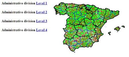
We arrived safely. We descend and we are surrounded by a set of brick-colored buildings. Outgoing and incoming volumes. Small windows whose white frames complete the set. We advance through the main patio and we are before the entrance door. We enter. We come with a defined purpose, therefore, after the corresponding permits we go to the Publications area. They tell us that there is a fast and direct way to get there. We welcome the suggestion and our attention is now focused on locating the shortcut. If we used the 'conventional map' provided to the public we would arrive in this way:

Showing the stored information
With much expectation we went to the designated place and after crossing a corridor, we found three doors, each one with an indicative sign. We must choose which one to start with. We start with the one on the left:

a) The door Books
We are in front of a shelf which increases the quantity of its volumes every so often. The copies are shown in this way:

Currently this area has 28 copies They can be read and downloaded for free in different formats.
First Tip: As the titles cover diverse areas and interests, we consider that it can be useful categorize the presented copies, this as an aid to facilitate the search:
| Category |
Titles |
| Analysis and News | · Crisis, globalization and social and territorial imbalances in Spain |
| Cartographic | Spanish cartographers
· History of cartographic projections The world of maps · Cartography of Land Occupation in Spain. SIOSE project. |
| Geodesy and Astronomy | Astronomy Questions
The measurement of the Earth between 1816 and 1855 |
| Logs | · The Topographic-Parcel Surveys of the General Statistics Board in the municipality of Almería (1867-1868)
· The Topographic-Parcel Surveys of the General Statistics Board in the Municipality of Soria (1867-1869) · The Urban Planimetry of Granada drawn up by the General Statistical Board (1867-1868): an unfinished project · The Great National Cartographic Projects of the XNUMXth century. The representation of the territory in Castilla y León Maps and cartographers in the Spanish Civil War (1936-1939) · The planimetry of Madrid in the XIX century · History of the Demarcation of the Hispano-French Border: From the Treaty of the Pyrenees (1659) to the Treaties of Bayonne (1856-1868) |
| Miscellaneous | Stories of a Field Surveyor
Trip to the Sierra de Segura From the ocean to Venus |
| Rules | Standards Guide
Latin American LAMP Metadata Profile Version 2 |
| Seismicity | · Theory about the propagation of seismic waves. Waves Lg
· Update of seismic hazard maps of Spain 2012 |
| IDEE - Infrastructure Spatial Data | · III Iberian Conference on Spatial Data Infrastructures (2012)
IV Iberian Conference on Spatial Data Infrastructures (2013) Introduction to Spatial Data Infrastructures Blog IDEE, 1000 post · Fundamentals of Spatial Data Infrastructures |
| Place names | Toponymic Guidelines for international use for map publishers and other publications
· Toponymy: Standards for the MTN25. Basic concepts and terminology |
Each volume has an associated "catalog file" which provides us with a brief description of its content as well as information such as the Author, Date of Edition and Number of pages. Once the title has been chosen, we find out the available formats and obtain a "copy" of the same. Simple truth?
Second Tip: Let's take any two books to comment on our impressions. Well known is our love of maps so our first choice is not a surprise for you. The second choice is related to the experiences of our work. Let's see:
The World of Maps It is characterized by its easy reading and understanding. If we look at the general index, we notice a structure of contents very well organized by themes. Ideal as a reference text for beginners and also initiates. Definitely recommended. Plus point.

 Stories of a field surveyor located within the Miscellaneous category, this enjoyable reading book can provide us with pleasant moments and will surely remind us of stories lived or heard by our co-workers. And although we are warned not to fall procrastination, a reading like this can help us to rest in our leisure time. Point in favor for the book.
b) The Door Bulletins
The Bulletins of the IGN and CNIG are intended to disseminate the activities of the institution. Accessible in PDF format, the last one published is from the month of September. As expected, you can access the previous numbers just by choosing the year and then the month of the desired newsletter.


c) The door Publications
We are facing the last door of our virtual tour. We rest a moment before continuing. They indicate that in this last room there is a lot of information. Let's check it We enter. We are in front of four rooms. Let us begin:
c-1) Activities Report. If you want to obtain an annual report of the activities carried out by the IGN and the CNIG, this is the right place. We ask about this and they indicate that the last document dates from the 2015 year.

c-2) Publications and Seismic Bulletins. Surely it is the room that contains the most information. The geofumed researchers will be happy here without a doubt. It requires a "deep immersion" in the content of the four (4) different shelves:
- Reports and other Publications
- Seismic catalogs
- Studies of singular earthquakes
- Search for Bulletins
As a small preview, we let you observe the contents of the "Reports and other publications" shelf:

c-3) Geographical Engineers: Basic Program and Bibliography (year 2008). This area consists of the basic syllabus and the recommended bibliography in order to help in the preparation to obtain the oppositions as a Geographical Engineer. Reviewing the Bibliography you can find access to different documents published on the Internet. Those who wish to review concepts are invited for a thorough review:

 c-4) Calendars. Do you want to get next year's calendar and ad portas? Well, the IGN provides you one as a souvenir of your visit. We are very grateful and we suggest: Take the opportunity!
Conclusion
It has been a long journey, without a doubt, on the way out, they say goodbye very kindly and invite us to return when we wish, which we appreciate. Now we must return and leave Ibero. Countdown. We return without incident. We hope you have found the tour interesting and instructive. Remember that the address is www.ign.es. Until a new opportunity!