The University its relation with the professional Cartographer
Considering the evolution of the scientific-technological knowledge, the advances, and the new configurations of the technological applications immersed in an increasingly globalized world is that it is essential to advance in the academic formation of people able to respond to the different territorial requirements, since a cartographic perspective, with an ethical, reflexive, creative and innovative attitude in the processes of capture, transmission, analysis, administration and representation of spatial information; what today we relate to the Map Maker.
This is the case of the Metropolitan Technological University of the State of Chile, which will soon be referring to the Cartographer-Geomatics, professional that will be formed from the year 2014
Historical Background
Under the aegis of the University of Chile, institution of higher education of national, public and the oldest in the country (founded in the year 1842), it is where the need to have professionals in the same field of Geography begins to be evident . It is there where the creation of the career of Cartography arises, dependent on the Department of Geography of said house of studies.
Who was to think that in the decade of 1960, Chile would require of a suitable professional for the correct representation and transmission of the existing elements in the territory, that also was an important pillar for other disciplines that required a Cartographic representation of certain phenomena and / or natural or social scientific processes (Economists, Botanists, Geologists, Urbanists, Doctors, among others); we talk about the Map Maker.
Later in the decade of 1980, from the reform in Higher Education made in Chile, the Professional Institute of Santiago (IPS) was created. The cartography race from the University of Chile is ascribed to this new institution while taking into consideration the modern scientific and technological aspects of that time. The School of Cartography, at that time, as an academic unit is ready for the realization of teaching, research, extension and technical assistance within the guidelines contained in the Mission of the School.
 In the year 1993 creates the Metropolitan Technological University of the State of Chile (UTEM) institution that to date, has been the continuator and heir of the legacy of the Cartography Career; organism that has also been able to form in an integral way Cartographers of excellence, with emphasis on the Scientific, Technological and Social Awareness of the events that occur in the country.
Cartography, like Science in Chile, is taught only in the UTEM, institution of Higher Education of the State of Chile and that facing the new challenges points to the evolution of its academic heritage of the Professional Institute of Santiago and the University of Chile
The Metropolitan Technological University of the State of Chile, Mapping and the future.
Currently, as Cartographers, we know that we must coexist and coexist with other professionals in the Earth Sciences (Geographers, Geodetectors, Geomaticians, Geomatics, among others), which as a whole intervene in the process of taking and analyzing data for different purposes, but given that their disciplinary objectives escape the generation of cartographic products; task that by origin is own and exclusive of the Cartography.
Based on the above is that from a technological point of view and according to the times requires a professional capable of planning, administering, evaluating and developing projects that contribute to the knowledge of the territory and provide solutions for its management and sustainability through the quality of the data and the efficiency of its representation.
 The Metropolitan Technological University of the State of Chile aware of this requirement assumes the challenge and commits itself through the School of Cartography to contribute to the development of the country with the preparation of the future Geomatics Cartographer.
Attentive to what happens in the external environment, as an academic unit and members of the Curriculum Redesign Committee of the Cartography Career, we are part of the timely incorporation of new theories, new methodologies, knowledge and use of technological tools of their own , and most importantly: To develop in the student the investigative role, both autonomous and interdisciplinary, through the application of the Scientific Method and related techniques.
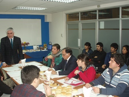
In order to carry out the redesign of the current curriculum, we have considered the opinion and contributions of the key entities to model and materialize the ideal curriculum according to the needs of the country. Academics, Students, Employers, Profession Cartographers, Professionals of Geosciences, among others have contributed with their "grain of sand"
In fact, together with the aforementioned curriculum redesign, this new challenge is accompanied by a new institutional educational model, which places the student at the center of the learning process; a guideline that is being applied to the different Universities of the State of Chile by virtue of the improvement of the teaching and learning processes.
Our challenge is also to position the current Professional Cartographer and to promote the future Geomatic Cartographer graduated from UTEM as fundamental professionals in the processes of cartographic production, cartographic production and integral management of the territory to students of primary, secondary and related disciplines .
All this work of Curriculum Redesign, has to be reflected in the following result:
| METROPOLITAN TECHNOLOGICAL UNIVERSITY OF THE STATE OF CHILE |
| FACULTY: Faculty of Humanities and Social Communication Technologies |
| SCHOOL: School of Cartography |
| NAME OF STUDY PLAN: Cartography and Geomatics |
| ACADEMIC DEGREE: Bachelor of Science in Cartography and Geomatics |
JOB TITLE: Geomatic Mapper
|
| INTERMEDIATE TITLE: University Technician in Geomatics |
| DIPLOMAS: Diploma in Geographic Information TechnologiesDiploma in Territorial Information ManagementDiploma in Cartography for Environmental Management |
| TYPE OF PLAN: Regular |
| WORKING DAY: Daytime |
| REGIME: Semiannual |
| DURATION: 10 Semesters |
| METHOD: Onsite |
| TYPE OF INCOME: PSU (Proof of University Selection, Process of admission to the Chilean Universities of the State). |
| TOTAL SUBJECTS: 58 |
| TOTAL SCT SUBJECTS: 300 SCT (Transferable Credits System, corresponds to the distribution of the academic work of the student, modality to be implemented in the future in the universities of the country. |
Finally, to mention that by the end of the month of August of 2013 the curriculum should be approved by the different collegiate organisms of the UTEM (Faculty Council, Academic Council and Superior Council), then to be included within the academic offer for the Admission 2014, where a strong diffusion campaign will be made, in addition to socializing it in the meeting instances of Geosciences.
The members of the Curriculum Redesign Committee of the Cartography Career thank you for the time spent in reading this portrait, and invites you, if you require more information about the work developed, to contact the e-mail esc.cartografia@utem.cl
On behalf of the Curriculum Redesign Commission of the Cartography Race, you are very kindly greeted by the reader;
JUAN NAVARRO MUNDACA
Degree Student of Cartography
Metropolitan Technological University of the State of Chile
Santiago, Chile, August 2.013


