The Bentley Map V8i Changes in 2011
On April 7, Bentley held an online conference, where it has shown the products for the geospatial area formed in the so-called Bentley Map (Select Series 2). The event was led by Richard Zambuni, Global Director of Marketing in the geospatial area and Robert Mankowski, Vice President of Development.
The potentials based on advantages that Bentley believes to have have been presented: a GIS tool with CAD precision, direct integration to Engineering lines, natively support many vector formats, on-the-fly rendering and capabilities for 3D Cities.
The changes in what we have seen in the last two years are significant. MapScript and Cadastre disappear and become part of Bentley Map, while PowerMap seems to diminish its capabilities towards PowerView and a new business line emerges for high smokes.
Basically the line has been left with three main products:
- A lightweight version called Bentley Map PowerView,
- A full version named Bentley Map V8i
- And a business line called Bentley Map Enterprise V8i
More or less what I expected In my assumptions, although I hope to clarify some doubts in the BeTogegher. Let's see what difference there is And what legacy products are included:

Bentley Map PowerView V8i
It is like a version similar to the well-known PowerMap, but cheaper. You can create maps, edit xfm data, read Bentley I-models, import spatial data, load raster layers, build applications on top of the API.
This version supports Markup, which is something like what Redline used to be for future revisions. I do not yet understand what they call it: Layered “For MicroStation” Installation Which is disabled for this version.
The creation of maps is limited to a single model per dgn although I have already passed a tip to skip this close and editing data within a space base requires a Geospatial Server license running with a connector to Oracle Spatial.
We understand that with this version it would be almost what PowerMap would do, although I will wait to download one and test it because it seems that there are several diminished capacities although it is not. Although it can be developed on this, it would be necessary to see in what conditions is the Geospatial Administrator and how much of Microstation is included in its vector editing capabilities.
Bentley Map V8i.
This version, in addition to the PowerView capabilities, supports data export to I-models and other geospatial formats, data editing on a spatial basis. Also this version supports 3D modeling, although only on vector layers and can convert labels to annotations.
What is new in this version is that it has been integrated Cadastral Mapping Configuration to the package, which disappears Bentley Hotels And the program includes good smokes for the management of multilevel topologies, interaction with COGO data and tools for transactional parcel editing.
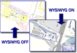
 The other tool that is integrated is Advanced Map Finishing, or what we used to know as MapScript. It has several functionalities for handling printing under an intuitive approach, it includes very good effects such as transparencies and postscript output module management with greater control to send to PDF.
Another great built-in functionality is the Extension for FME, with which you can interact with almost any vector and spatial data format. One of the best I have seen in terms of interoperability, knowing that FME will be one of the main outputs with which we will see CAD and GIS merging into a single routine.
Several commands have been integrated, some as new and others modified, such as the separation of processes in the Fence and editing raster data that I hope to review in another post.
Bentley Map Enterprise V8i
This version is for high smoking processes. Includes texturing on 3D models, DEM, indexing, display and editing of indexed raster layers in an Oracle database, 3-Dimensional spatial analysis with flow for decision making.
From this, possibly we will soon be seeing 3D smart city projects by Canadian and Danish projects. At the Hispanic market level, there are many elementary things to solve to think about applying this type of project; maybe in Brazil or one of the countries where Charter Cities are promoted we can see something.
______________________________________________________________
In general, we find an interesting passage from Bentley, summarizing different products of the geospatial field in three scalable: One light, one complete and one astral.
Bentley Map is a high-level software for geospatial projects, with capabilities that surpass many others in the competition.
The change at no time affects the logic of previous processes, there are no new formats, rather consolidates applications that were already days in the Gent capabilities of Bentley Map.
However, it continues to be an application with a good position only in the market where Bentley has its strength, mainly in Civil and Industrial Engineering and, in very large markets (United States, some European countries, India, Brazil) to give a few examples. With everything and the loyalty achieved by the users of this brand, its position is low at the level of CAD users when compared to AutoDesk users; while in the GIS environment, by including other applications it has a slightly more competitive level compared to AutoDesk but continues to be very low when compared to ESRI.
We are aware, they are different markets and different platforms integration logic. While AutoDesk has recently exploited the design market and tries to merge mapping with Engineering, ESRI remains purely GIS, Bentley prioritizes Engineering and as a plus has dabbled in GIS but with a focus on its existing customers.
This situation, given the generation of sufficient profits and relative positioning, closes the doors towards the recovery of foreign territories.
In the case of Bentley, it must be recognized, that in terms of capabilities, Bentley Map has the potential to do almost anything with great integration to web development, Engineering projects, transportation, Plants and BIM trends. But for novice user purposes, buying Bentley Map on the web, opening the box, the manual, installing and then wanting to implement a project is not very easy, nor is there much material on the Internet where you can find developed examples with which to guide yourself. Formal training and assistance is required, understandable but which are also barriers to the growth of this software towards new users who are used to popularized free or proprietary software.
In this sense, we will see more the growth of Free GIS users than of Bentley Map. Although at the company level, large cadastre projects, engineering firms looking for more, Bentley Map is a great alternative.


