Seminar on PowerCivil Latin America
Engineer Edmundo Herrera will be offering a seminar on the functionalities of the product that Bentley adapted for Latin America, coined as PowerCivl Latin America, as was done exclusive dealer for Spain.
Date: 15 July 2009
Schedules: 10: 00 am (Mexico) 12: 00 pm (Argentina)
Duration: 1 hour 30 minutes
Cost: Free
Instructor: Ing. Edmundo Herrera
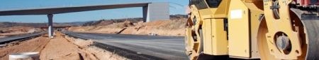
PowerCivil is similar to what was done with PowerMap, but with adaptation of Geopak Engeneering Suit with the most used programs in Civil Engineering, especially in the area of Roads, although its application of linear works and infrastructures has functionalities for Airports, Retaining Walls , Hydroelectric, Mines, Platforms, Bridges and Port Engineering.
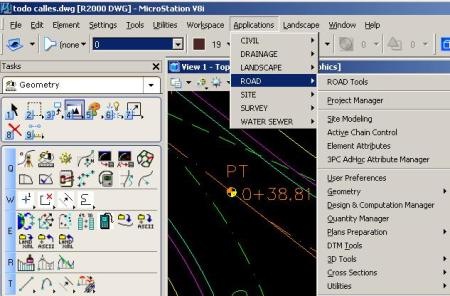
 PowerCivil takes the advantages that it makes Bentley users loyal, especially due to the work logic in panels that indicate the sequence graph that carry the main processes in the design and control of civil infrastructure works, apart from the processing speed On Microstation it is undoubted, doing operations with large volumes of data without sacrificing the resource, which they managed to maintain when going from the V8.5 versions (in Clipper) to XM and V8i. Here are the main advantages that Bentley announces with respect to PowerCivil:
PowerCivil is the only software made and that contains its own standards for Latin America, some of the characteristics that distinguish it are:
- Intersect multiple surfaces to generate volumetric by strata.
- Generate sub-surfaces from drill files.
- Automatically generate plans in plan, plant / profile, profile with feet of plans automatically filled according to own data of the project.
- Make complicated transitions between different retaining wall materials.
- Automatically install retaining walls as soon as they are needed.
- The generated reports have stratigraphy information, not just cut and simple fill.
- Any thickness change in components in Power Civil Latin America is parametric.
Axes annotations are easy, friendly and done in seconds
Power Civil Latin America has a system for quantifying elements based on payment codes to make reports connected to a dynamic file to obtain the calculation of work costs.
- It works like no other, works perfectly with real and huge data in a matter of seconds (Triangulation of 300 Megabytes file surfaces, in less than 1 minute).
- The changes to the project are made in real time and efficient.
The largest bathymetry in the world, the Panama Canal, uses it as standard since 1993. - Technical support in Spanish.
- Extremely friendly to the user. The most difficult designs are done in an organized and easy way.
- Volumes made in seconds.
Profile-friendly annotation
The surfaces are not made of triangles, the model is triangulated plus the surface is made from intelligent features that can be visualized and projected into profiles to eliminate a series of errors in construction.
Here you can register, and here you can learn more about PowerCivil