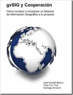
Introducing gvSIG and Cooperation
 With great pleasure we present the publication "gvSIG y Cooperación", a work that seeks to be a reference in terms of systematization to promote the dissemination of this application in cooperation projects as a sustainable alternative.
A document of this level was already necessary, which comes at a good time, when gvSIG is about to launch a new and promising version. The line of this document is similar to the one previously produced by the same institution called "Epanet for Cooperation" with the difference that in this case the exercises come in the same document.
This book is promoted by Engineering for People (UMAN), a company dedicated to promoting the impact of humanitarian organizations through training and consulting, which dreams big with this product because with this first edition that came out last month of November could be one of the most outstanding dissemination tools regarding free GIS in the Hispanic environment. I was struck by the copyright legend that says:
All rights reserved. You can photocopy this manual for your personal use if your financial situation does not allow you to buy it. If not, consider supporting these causes by purchasing a copy.
The book can be consulted online at, can also be purchased for a price of 30 Euros.
Although the document seems to be a reference for decision-making institutions, as it is elaborated it is more adapted to a manual with a very practical methodological adaptation. The graphics, examples and images reflect a great job, to show a button.

This is the summary and index:
gvSIG and Cooperation.
How to build and incorporate a GIS into your project
In this manual we have proposed to popularize the SIG in Cooperation, to serve it without hardly effort nor cost so that you incorporate it to the day to day of the projects with the same ease with which you browse the Internet or read the email.
This collection of commented exercises and applied explanations wants to get up quickly, providing you with the necessary tools to build your first GIS system in a short time, approximately 16 hours.
I. Why GIS is important to you
What is the SIG ................................................................................. ..5
In what power the SIG your work ...................................................... 6
SIG, a bird on land ..................................................................... 9
Objectives ....................................................................................... ..10
How is this book organized ................................................... .11
II. The theory you will need
Thinking spatially ............................................................... .17
The 10 key minutes ..................................................................... ..19
The importance of the data collection form ........................ 21
Particularizing with a GPS ......................................................... .26
Navigating with coordinates ......................................................... 30
III. gvSIG in tutorials
Introducing gvSIG ........................................................................ 39
Downloading gvSIG and manuals ................................................... ..41
The elements in gvSIG .................................................................. 47
Exercise 1. Creating a new project .......................................... 51
Exercise 2. Creating a view ...................................................... ..53
The layers ....................................................................................... .57
Exercise 3. Downloading data from the web ............................................. ..59
Question of CRSs ........................................................................... 61
Exercise 4. An essential ritual ................................................ .62
Exercise 5. Adding layers ......................................................... ..66
Exercise 6. Working with comfort .......................................... .70
The tables ....................................................................................... .71
Exercise 7. Fretting your first table .......................................... 72
Facilitating interpretation ............................................................ .75
Exercise 8. Modifying the appearance of the layers ........................ .77
Five key tools ............................................................... .87
Exercise 9. Incorporating a locator .......................................... 89
Exercise 10. Passing query ...................................................... ..92
Exercise 11. Creating areas of influence ....................................... 99
Exercise 12. Incorporating background images .............................. .111
Exercise 13. Drawing layers ...................................................... ..119
Exercise 14. Adding data from a GPS .................................... ..127
Exercise 15. Checking layers ................................................ ..134
Publishing a map ..................................................................... ..136
Exercise 16. Publishing a map ................................................ ..138
IV. Debuting with a case
Preparing the base .................................................................. ..155
Adding the data of the elements .................................... ..160
Analyzing the data ............................................................... ..165
As a farewell .................................................................. 172
V. Tool box
Where to get maps ............................................................... 175
Where to get data and layers ................................................... .176
Where to get help ............................................................... .178
Common failures ........................................................................... ..179
Lightning stroke of spreadsheets .......................................... .138
About the authors ........................................................................ .185
Bibliography ................................................................................. .187
See book online


You can also read online
http://books.google.es/books?printsec=frontcover&id=Jv8zsrhRupgC#v=onepage&q&f=false
Thank you Nancy, I long ago hoped to have some response to give to the people who were looking for the book on the Internet.
The link to choose any of the publications is:
http://www.arnalich.com/es/libros.html
Choose the desired book by clicking on the read online link, or, pay the requested amount through Western Union
regards
Nancy
No kidding, it looks like they had it for a while and then they removed it to upgrade it to the 1.9 version.
Will have to wait, who knows March
What a bad wave, as they would have left it
Pin "See Book Online"
… And a legend appears: Back in March
??
what is that?
A joke?