Import images and model 3D from Google Earth
Microstation, from version 8.9 (XM) brings a series of functionalities to interact with Google Earth. In this case I want to refer to the import of the three-dimensional model and its image, something similar to what it does AutoCAD Civil 3D.
These functions are activated by:
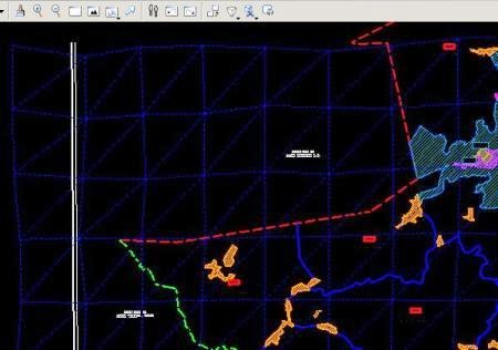
Tools> geographic
or in case Microstation is in Spanish, which in practice costs to adapt:
Herrameintas> geographic
This is a functionality of any platform running on Microstation, such as PowerCivil, Bentley Map, Bentley Coax, etc. The sixth and seventh icons serve, one to synchronize the Google Earth view based on the one we have in Microstation and the other to do the reverse. The fourth icon is to bring the Google image to the map.
1. The dgn file
To start, this function requires that the dgn file is 3D, in case we have a file built with seed 2D what should be done is:
File> export> 3D
 Then we open the file that we have exported. The other must-have feature is a geographic reference system. This changed a bit after Microstation 8.5, but it generally recognizes an assigned system with those versions although sometimes it just mentions that it is A UTM system but it does not define the area. In case you don't have one, it is done using the first icon of the bar that I showed at the beginning of the post and choosing the system that interests us from the library. In this case we must assign a projected system (northing, easting ...) and we choose the World (UTM) option with WGS84 datum, as it is the system that Google Earth uses.
To not be fighting so much, you can assign the system to the favorites and thus should not be searched every time we require it.
In the case of Google Earth, it is convenient to hide the compass, the status bar, the grid or any other element that does not interest us. It is also possible with the option of Historical images that came from Google Earth 5, turning off coverage of years that we are not interested in, many times the most recent ones are less visible. Once ready, we must choose the area of interest, and synchronize between Google Earth and Microstation.

There is a panel that provides us with some configurations, but in practice they are not as useful as the vertical reference system used by Google Earth is quite simplified, with some exceptions in some areas of the United States and Puerto Rico. So it makes little sense to choose the altitude deviation; What is important here is to define whether a triangulated mesh or a grid will be used; The option "view terrain" must always be active.

2. Import image
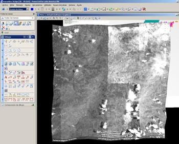
To import the image you just have to choose the fourth button on the bar and click on the screen. As a result we will receive the captured reticle.

To see the image, we make: Tools> render> View, And with this we raised a panel in which we decided some configurations of the type of rendering, line visibility and brightness of the image.

To see the model in isometric, we do it with the tool that is on the View, and we place an isometric well we rotate it freely. See that it is even possible to render only a fenced area with fence or a zone based on an object. And if we choose the option stereo, we can see the work with stereoscopic lenses -Of those we forgot to return when leaving the cinema-. The panel that I show below differs a bit according to the application, because in this case I am using PowerCivil Which has more rendering options.

The image comes in grayscale and quality is little less than lousy as it is only one Print sreen; improves when using the Google Pro version and keeping Google Earth in DirectX mode. In the case of the digital model, it cannot be improved more than what Google offers, however this seems a quite practical way out for complementary work with Stitchmaps, With which you can download a higher quality image and With this one can be geo-referenced.
Although to be shown occupy is rendered as it is a digital model and not an image, every time a change is applied to the rendering, an image is generated in the same directory, which can be loaded separately with the raster manager.
Clarifying a couple of doubts: 3D buildings are not brought, as these are not part of the digital model and the precision of the model can be improved by making smaller captures. Take the example of San Sebastián, where the quality of information is a luxury; on the right is the same shot taken at different levels of zoom.

Until now, PlexEarth Takes the merit as the best integration tool between Google Earth and a CAD platform.


To request an evaluation version, contact Jesus.Zenteno@bentley.com Who is representative for Central America and Mexico.
There on the website is a contact email.
I want the URGENT PROGRAM where I register and download
En Bentley.com
Of course, it's not free.
If you register in the SELECT service it is possible to request a trial version, if your profile applies.
Where can I download this tool to use in my googleEart