
How to teach a Microstation course
A few days ago someone asked me about the course I was giving from Microstation based on the most used 36 commands, and about which I said I initially used it to teach the AutoCAD course, but later I did the version for Microstation.
Well here I share the course plan, as I developed in those years ... that some nights of lonely hotels I miss.
SUMMARY OF THE MICROSTATION COURSE
This is the basic file, which although some criticize it as unnecessary, from a marketing point of view helps to sell the course to the company that is paying.
| Name: | Microstation course V8 applies for XM |
| Duration: | 24 Hours (40 ideal) |
| Effective time: | 22 hours, but closing 1 and 1 for contingencies |
| Date: | |
| Means : | Laptop, projector, projection screen, one computer per student with Microstation V8 and Bentley View installed, with power source, mice with scroll wheel, Formica blackboard, three-color markers and eraser, user manual, instructor's manual. |
| Course Description: | The course is intensive and is oriented to develop in a theoretical-practical way with real exercises, requires each student to have their own computer and have basic knowledge of Windows environment. |
| instructors: | |
| No. of students: | ideal from 8 to 12 |
| Company: | |
| Location: | |
This is the summary of the course, and although the ideal is 40 hours, here I show you an example as I should have compacted for 24 ... difficult but you can if you have the conditions and small group
| Phase | Description | Time | Contents |
| I | Introduction | 1 / 2 hour | Presentation, course presentation, introduction to Bentley products, CAD equivalents, brief user evaluation |
| II | Basic concepts | 1 / 2 hour | MS requirements, basic concepts of open, save, close, view, scroll, levels |
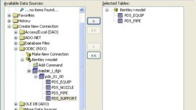
| III | The most used 36 commands
6 Utilities most used |
13 hours | Development of the concepts and practices of 14 authoring commands, 14 editing and 8 reference, making practical exercises, together of the 6 most used utilities, the student is marking in the summary sheet of commands and utilities. |
| IV | The 4 More complex utilities | 8 hours | Exposure of the most complex features of Microstation, such as printing, dimensioning, configuration settings |
| V | Closing + unforeseen | 2 hours | Implementation of the vision of the applications that work with the platform MS, sample of some examples, delivery of diplomas, evaluation of instructors |
As I mentioned before, the course is based on learning the most used 36 commands from Microstation and the most important 10 applications, but on real work under the technique of learning by doing; I recommend that you see the post where I talked about it.
DAILY COURSE PLAN
Here you plan the time that will be managed to develop the different commands and exercises ... I also take the opportunity to apologize for how extensive the post will become 🙂
FIRST DAY
| TEMA | WEATHER | CONTENT | EJERCICIO |
| Introduction | 1 / 2 time (30 min) |
|
Students will complete assessment sheet |
| II Basic Concepts | 1 / 2 time (30 min) |
|
Open examples applied to topography, architecture, construction |
| III A 6 Group Commands __________ Application to Architectural Facades | 2 hours (60 min)
|
|
Students will develop two simple facades using only these commands |
| III B 10 Group Commands __________ Application to Mapping | 3 hours (180 min)
|
|
Students will work with a scanned image and scan the image using these commands |
| III C 5 Group Commands __________ Application to Surveying | 2 hours (120 min)
|
|
Students will work with a traverse using bearings and distances, will close and calculate the area.
They will also do the same using deflections |
SECOND DAY
| TEMA | WEATHER | CONTENT | EJERCICIO |
| III D 7 Group Commands __________ Application to Construction Details | 3 hours (180 min)
|
|
Students will work on a structural detail that includes steel reinforcement, concrete hatching, natural terrain etc. |
| III E 7 Group Commands __________ Application to blocks and Templates | 3 hours (180 min)
|
|
Students will make the cell the previous structural detail, and create two more and manipulate an existing one |
| IV A Complex Profits __________ Application to the Treatment | 2 hours (120 min) |
|
Students will mark the completed drawings |
THIRD DAY
| TEMA | WEATHER | CONTENT | EJERCICIO |
| IV B Complex Utilities __________ Losing Fear of Printing |
2 hours (120 min) |
|
Print drawings made |
| IV C Complex Utilities __________ File management | 2 hours (120 min) |
|
File Manipulation |
| IV D Complex Utilities __________ Most important advanced settings | 2 hours (120 min) |
|
Manipulation of settings |
| V Closure | 2 hours (120 min) |
|
Instructor evaluation, interactive debate |
I hope that some of my former students inherit the taste for training in this field... which so much needs "non-academic" training but practical training.
And it's not that I do not teach anymore, I do not have the same time but I'm still available, so there they let me know.


Saya menulis artikel ini beberapa tahun yang lalu, berdasarkan kursus yang saya ajarkan.
Ini tidak lagi tersedia.
Salam
bisa kasih refensi buat kursus microstation, .di mana tempat dan berapa harganya, ..
tutorial bahasa indonesia apakah ada