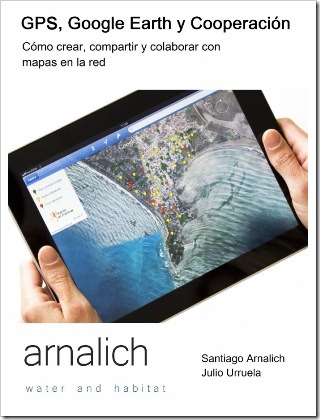
GPS and Google Earth in Cooperation
4 years after review GvSIG and Cooperation, We are pleased to disseminate a new publication Arnalichm an organization of professionals created to enhance the impact of humanitarian actors with technical support, consulting services and training in the field of drinking water supply and Environmental Engineering.
 We refer to the new book:
GPS and Google Earth in Cooperation.
The document positively abuses a level of simplicity, explaining in detail images, steps and chronological exercises the creation, sharing and collaborative use of geographic information using the resources that exist on the web, including Google Earth, Google Docs, GPS Babel, GPS Visualizer, Dropbox, among others.
It is definitely an important contribution at this time when almost everything we do has a development background and that we must demonstrate in a practical way. Although the document does not focus on a broad level, it leaves the tickle to see that with simple tools you can show results.
The composition of the document is integrated in at least four sequential parts:
Google Earth
The first one talks about Google Earth, with elementary principles in the management of layers and use of the tool. It is obvious that this part is in abundance for medium-level users, however, the scope that this type of document can have in a context of decision-makers who are often people with high specialization in the field of social development but with little update what can be done with basic computer tools.
Almost playing, Google Earth has become an invaluable tool for purposes Educational scope y Demonstrative of the application of earth sciences that in other times could only be handled by specialists. On this, the document seems to focus its attention from a practical point of view with topics such as:
- The assimilation of the concept of layers of information
- Create points, lines and polygons
- Open files kml / kmz
- Upload images
In my opinion, it falls short in referring to how to make a kml file outside of Google Earth. Usually people have layers of type shape file, dwg or dxf that they expect to visualize in Google Earth, and I think that in this there could be a section that at least mentioned with which programs this conversion can be done.
GPS
The second chapter is focused on the use of GPS, with a broader level for those who could underestimate the theme of the first chapter. Basic aspects, very well explained, as it exists in other documents; but its added value is in the concatenation of topics, because outside of being a copy / paste it focuses on the simplicity of those who do not know about the subject but who have little time to understand it.
Apart from basic topics of cartography, projections, navigation theory, use and configuration of GPS, the most interesting is its link with Google Earth in continuity with the theme of the first chapter. For those who start in the GPS field this section is very good, a great effort to summarize the most important theoretical issues and empty them from a technical, practical and chronological point of view.
Drill
The third chapter is just exercises that go up from the degree of difficulty, from the creation of layers to the advanced use of Excel for thematic formulas in maps published on the internet from csv files.

At this level, users who thought they knew everything about Google Earth can be surprised, because it shows how to make folders or a legend that is contained in the kmz and that can be seen by showing the layer in Google Earth.
Share and collaborate
Finally, it explains how you can work collaboratively using the Internet.
In conclusion: An important contribution in which we sure will find something new, but above all with which you can motivate people not started in this field to become passionate about geography.
I recommend to take a look and save it in your favorites because not every day arrive and stay online these news.
Here you can buy the book http://www.arnalich.com/es/goops.html
Here you can Read online
The exercises in the book can be download here


