
Accredit service providers in Cadastre
In the next three weeks we will be conducting a training workshop aimed at creating service providers for a project that will carry out a cadastre in 65 municipalities. The intention is to accredit the technicians who will be hired by the municipalities to execute the projects that not only include strengthening in the cadastre area but also in Financial and Tax Administration.
The training process has been separated into three areas of ENAC accreditation:
1. Cadastral Survey and Valuation
This workshop includes three modules of one week each:
- Lifting by direct methods. In this case, sub-meter precision GPS will be used, the combination with a total station to tie up apple trees and a tape measure to measure fronts of buildings is expected. Although the methodology is defined by the teams available, it is expected to make an induction to other methods and even perversions that are viable using existing data, including Google Earth.
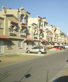
 Urban Valuation. For the valuation of improvements, the methodology "Replacement cost minus accumulated depreciation" will be used, this considers the use of the building, the class of materials and the quality of workmanship as basic field data through a weighting known as "weight" that accumulates the constructive characteristics of the building until defining the "typology" that applies to it. It is quite a smoke, very similar to the one applied in Bogotá but with some adaptations of regional folklore. For the valuation of urban land, the “market method” will be used.
  Rural Valuation. Included in this workshop will be the measurement by combined indirect methods, the valuation of rural land and permanent crops.
The valuation training includes the calculation of real estate tax according to local legislation.
2. Digital Mapping and Geographic Information Systems
This workshop includes three modules of one week each, and are simultaneous to the cadastral survey; in some days both teams converge to socialize and level some principles.
- Digital mapping using AutoCAD.
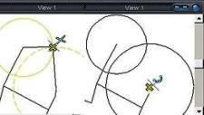 Although the time is short, it is expected in an intensive week to train in the digitization of cadastral maps from a GPS survey and apple tree sketches. The workshop includes the basic principles of cartography in the 1: 1,000 quadrant map nomenclature and generation of maps for printing.
 - Geographic Information Systems using ArcMap. Like the previous one, it is a light version of the GIS configuration from the data made in the data mapping, construction, editing and analysis module.
- Digitization of cadastre data. This includes the integration of data to an application designed to store the information of the file, tables of values and factors defined for the calculation and management of the property tax.
3. Local Finance
This workshop has already been given and was aimed at those who will provide training services and implementation of a Financial and Tax Administration System. It took place over three weeks and almost 30 providers were accredited.
This included theoretical training in legislation relevant to tax control and accountability, as well as the implementation of an application that automates the following areas:
- Tax Control
- Treasury
- Budget
- Accounting
- Public services
Coming
Needless to say, I will be very entertained with this for the next three weeks. The exercise may help me to validate some aspects in the definition of the competency model and although some of the applications used are not my preference, the standard is generic.


good to all I would like to know the procedure to take the cost of a coffee aplantita of 4 years to calculate the value of permanent crops thanks
I will be supporting the course, in support of a request made by a project that will carry out Cadastre in 64 municipalities of Honduras, with funds from the European Union. It will be taught near Tegucigalpa in the month of May.
I understand that courses like these should be taught by the National Cadastre of your country.
Hola!
We found the training workshop very interesting and we would like you to send us some information or link, where it is taught and others.
Ready, in the meantime you answer me about gvSIG because your address was bad when you asked for it
My email address was misspelled
I have sent to your mail the data of where they will be made so that you put in contact with those who handle the logistics
Where will they be giving the workshops? Who can attend? We are in El Salvador and we find it extremely interesting. Is there any way to get in touch with you?