
15th International gvSIG Conference - day 1
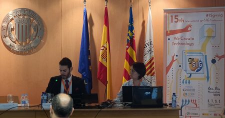
The 15th International gvSIG Conference began on November 6, at the Higher Technical School of Geodetic, Cartographic and Topographic Engineering - ETSIGCT. The opening of the event was carried out by authorities of the Polytechnic University of Valencia, the Generalitat Valenciana and the General Director of the gvSIG Association Alvaro Anguix. These days have just coincided with gvSIG Desktop 2.5, which is ready for download.
As Geofumadas we have decided to attend this event in person, during the three days, aware of what this free software initiative has represented, which today has been the initiative born in the Hispanic context with the greatest scope of internationalization.
 On this first day of the day the first session of presentations, was in charge of the representatives of the Institut Cartografic Valencià - Generalitat Valenciana, the CNIG - National Center of Geographic Information of Spain and the personalities of the Government of Uruguay, who presented the IDE of Uruguay implemented in gvSIG Online.
Subsequently, the second session continued, where IDE's would be discussed. On this occasion the representatives of the European Thematic Center of the University of Malaga were presenting their case studies, who talked about PANACEA. MED Biodiversity. Then, Raúl Rodríguez de Tresca - IDB took the floor, presenting the draft Geoportal for road management in the Dominican Republic, to generate support technology in the management of inventory of road networks and bridges. In addition, Rodriguez said the importance of his work is that more people are having spatial awareness,
"What we have achieved is open minds, there are currently common people linked to projects that request their inclusion to access the platforms and generate-manage data."
In this same thematic block, Ramón Sánchez de Sans2 Innovación Sostenible SL, showed gvSIG Applience focused on infrastructure control, that is, how to connect surveillance systems and integrate it with free GvSIG GIS, to promote infrastructure control and effective responses at the time of an event.
The third block of the day related to integrations, carried out by Joaquín del Cerro, representative of the gvSIG Association, presented the improvements and system updates for Accident management and integration with ARENA2 of the General Directorate of Traffic in gvSIG Desktop. Oscar Vegas on the other hand, presented the Manual sectorization of water supply network models from gvSIG with the help of ConvertGISEpanet and RunEpanetGIS tools, which are tools to generate hydraulic models of water supply networks, made visible how to transfer the information to the GIS, as well as the ease of file conversion and data presentation.

We continue with the last presentation of the 4to block with the presentation of Iván Lozano de Vinfo VAL, who very exhibited as VinfoPol, improved all the processes inherent to the police field, from locations, identification of criminal profiles, existence of fines among others. This tool is configured as a screen, where you can manage all the incidents of the police action area, "we create a comprehensive management to manage the entire system with which the police work from a single program."
Finally, we come to the end of the sessions with the theme of Mobile Devices. In this section, success cases were presented that were carried out with mobile devices, for example, Ing. Sandra Hernández of the Autonomous University of the State of Mexico, displayed information on the Organization and collection of data in the field through mobile applications and devices, for the evaluation of the walkability in the Historic Center of Toluca. With this project, attendees were able to visualize the field work carried out with the gvSIG mobile application, which is free and works offline without connecting to a Wi-Fi or data network, all this information collected later will be processed and analyzed in gvSIG Desktop, to generate reports on the mobility that the citizens of Toluca have and the infrastructure they have for their free transit.

The gvSIG Association promotes the inclusion in the conference not only of organizations or large companies, but also made visible the work of one of its students, Glene Clavicillas with its project Carrying out agricultural cartography through multi-temporal analysis of satellite images and cadastral cartography.
The rest of the afternoon continued with the workshops, where many signed up for free. The workshops included topics such as gvSIG for beginners, data analysis with gvSIG or ConvertGISEpanet - RunEpanetGIS - gvSIG for the treatment of information in water supply networks.
If you are one step away from Valencia, there are still two days left; in which we hope to cover interviews with key players that will give us their vision of where they think gvSIG will go in the following years.


