How to use historical images from Google Earth
As I told you last week, Today it would be launched the new version of Google Earth 5.0, and although we smoked some of what it could bring, I was impressed by the functionality to see the historical archive of images that Google has uploaded since the 2002 year to date.
An option appears in the upper bar to view the historical images of the displayed area, and the dates where there is an update are indicated. Simply great, because before it was only possible to see the last image, the previous ones being hidden; I guess it will continue to do so on Google Maps.
![]() The button on the right, in the form of a tool, allows you to configure a continuous animation of a certain period, also the speed of the transition.
The button on the right, in the form of a tool, allows you to configure a continuous animation of a certain period, also the speed of the transition.
Let's see an example of this:
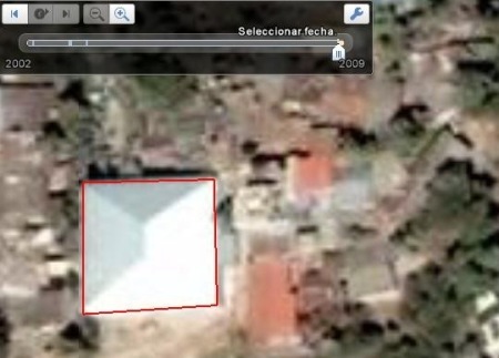
The view that I am showing is of a church, this is the last shot of the updated image in November of 2008, with its new roof.
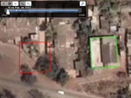
Now look at the same church, in the 2002 shot; note that the building with a new roof is not yet built. Ah, with a slight difference of 52 meters between one shot and another.
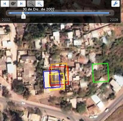
In the following graph the same building is marked in the different years of intake. In general, the last four are about 9 meters apart, only the first is more than 50.
The usefulness of this function of Google Earth is very practical for many purposes, among which can be considered:
- Urban growth
- Cadastral Maintenance Planning
- Planning of Reassessment for goods estate
- Deforestation and environmental degradation
We will see the implementation of this to the applications that have been developed on the Google Earth API. We will talk about other new tricks in version 5.0 later, among which is Ocean and video saving. In the meantime, here is a video that shows the history of the images.